1776 Declaration of Independence Advent Calendar

Click on the date to learn more about the item for that day
To be posted daily starting on December 1 at around 8 am Eastern.
Click on the date to learn more about the item for that day
Posted around 8 am Eastern.
Christmas Tree
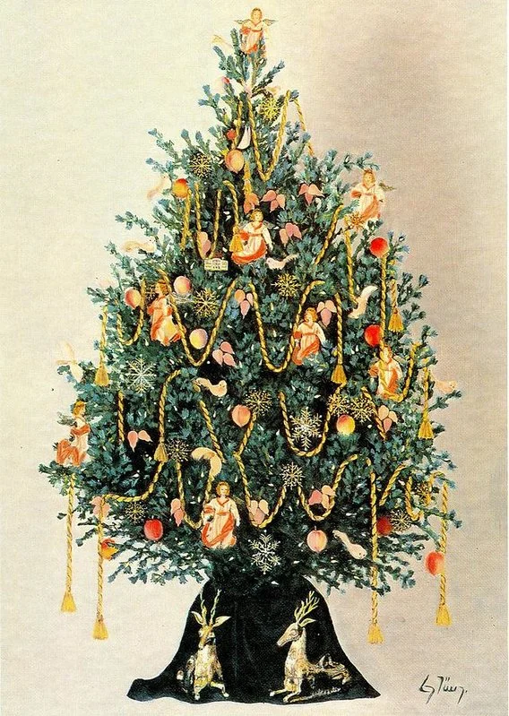
“Several cities in the United States with German connections lay claim to that country’s first Christmas tree.
“Windsor Locks, Connecticut, claims that a Hessian soldier put up a Christmas tree in 1777 while imprisoned at the Noden-Reed House, while the “First Christmas Tree in America” is also claimed by Easton, Pennsylvania, where German settlers purportedly erected a Christmas tree in 1816. In his diary, Matthew Zahm of Lancaster, Pennsylvania, recorded the use of a Christmas tree in 1821, leading Lancaster to also lay claim to the first Christmas tree in America. Other accounts credit Charles Follen, a German immigrant to Boston, for being the first to introduce the custom of decorating a Christmas tree to the United States. In 1847, August Imgard, a German immigrant living in Wooster, Ohio cut a blue spruce tree from a woods outside town, had the Wooster village tinsmith construct a star, and placed the tree in his house, decorating it with paper ornaments, gilded nuts and Kuchen. German immigrant Charles Minnigerode, entering into the social life of the Virginia Tidewater in 1842, introduced the German custom of decorating an evergreen tree at Christmas at the home of law professor St. George Tucker, thereby becoming another of many influences that prompted Americans to adopt the practice at about that time. An 1853 article on Christmas customs in Pennsylvania defines them as mostly “German in origin”, including the Christmas tree, which is “planted in a flower pot filled with earth, and its branches are covered with presents, chiefly of confectionary, for the younger members of the family.” The article distinguishes between customs in different states, however, claiming that in New England generally “Christmas is not much celebrated”, whereas in Pennsylvania and New York it is.”
Source: Wikipedia
Learn more
This timeline has the history of Christmas trees.
Has the additional information we publish here every morning been interesting? I’d be happy to get your feedback and suggestions. — Lee Wright | Founder
Treaty of Paris
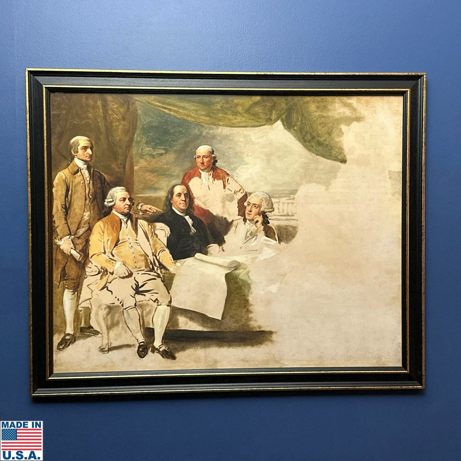
Pictured: American Commissioners of the Preliminary Peace Agreement with Great Britain, also known as the Treaty of Paris, is an unfinished 1783 painting by Benjamin West depicting the United States delegation that negotiated the 1783 Treaty of Paris, which formally ended the American Revolutionary War. Peace negotiations began in Paris on June 25, 1783, and the eventual signing of the treaty took place on September 3, 1783 at the Hotel York at 56 rue Jacob. The green drapery in the painting’s background and the distant landscape with a classical colonnaded building emphasize the scene’s formality.
“John Jay, John Adams, Benjamin Franklin, Henry Laurens, and William Temple Franklin (presented from left to right) are depicted early during the negotiation process (Laurens and the younger Franklin were not present at the treaty’s signing). Benjamin Franklin was the only U.S. delegate who did not pose in person; West drew his likeness from an engraving.
“Meant to be depicted on the right, the British delegation comprising representative Richard Oswald and his secretary, Caleb Whitefoord, declined to pose. Britain had no desire to commemorate its defeat, and Oswald was reportedly unattractive and blind in one eye and consequently reluctant to be depicted. The conspicuous absence of the British commissioners evokes the “tentative nature of the peace” and the “deep geopolitical antagonisms” that persisted after the Revolution. West never completed his painting. According to John Quincy Adams, West intended to present the painting as a gift to Congress.”
Source: Wikipedia
From the text of the treaty:
Article 1: “His Britannic Majesty acknowledges the United States, [illegible] New Hampshire, Massachusetts Bay, Rhode Island & Providence Plantations, Connecticut, New York, New Jersey, Pennsylvania, Delaware, Maryland, Virginia, North Carolina, South Carolina & Georgia, to be free sovereign & Independent States; that he treats with them as such, and for himself his Heirs & Successors, relinquish her all Claims to the Government Propriety + Territorial Rights of the same & every Part thereof.”
Article 2 specifies the boundaries of the new nation.
Article 3 deals with an issue that may be surprising to us today, but is a reminder of the importance of that industry in that period. And since this is closely related to boundaries, it is logical that it follow the article specifying boundaries.
“This agreed that the People of the United States shall continue to enjoy un- molested the Right to take Fish of every kind on the Grand Bank and on all the other Banks of New foundland, also in the Gulph of St. Lawrence, and at all other Places in the Sea where the Inhabitants of both Countries used at any time heretofore to fish. And also that the Inhabitants of the United States shall have Liberty to take Fish of every Kind on such Part of the Coast of New found land as British Fishermen shall use, (but not to dry or cure the same on that Island) And also on the Coasts Bays & Creeks of all other of his Britannic Majesty’s Dominions in America, and that the American Fishermen shall have Liberty to dry and cure Fish in any of the unsettled Bays Harbours and Creeks of Nova Scotia, Magdalen Islands, and Labrador so long as the same shall remain unsettled but so soon as the same or either of them shall be settled, it shall not be lawful for the said Fishermen to dry or cure Fish at such Settlement, without a previous Agreement for that purpose with the Inhabitants, Proprietors or [illegible] or the Ground.”
Learn more
View the Treaty of Paris on the National Archives site.
Related product
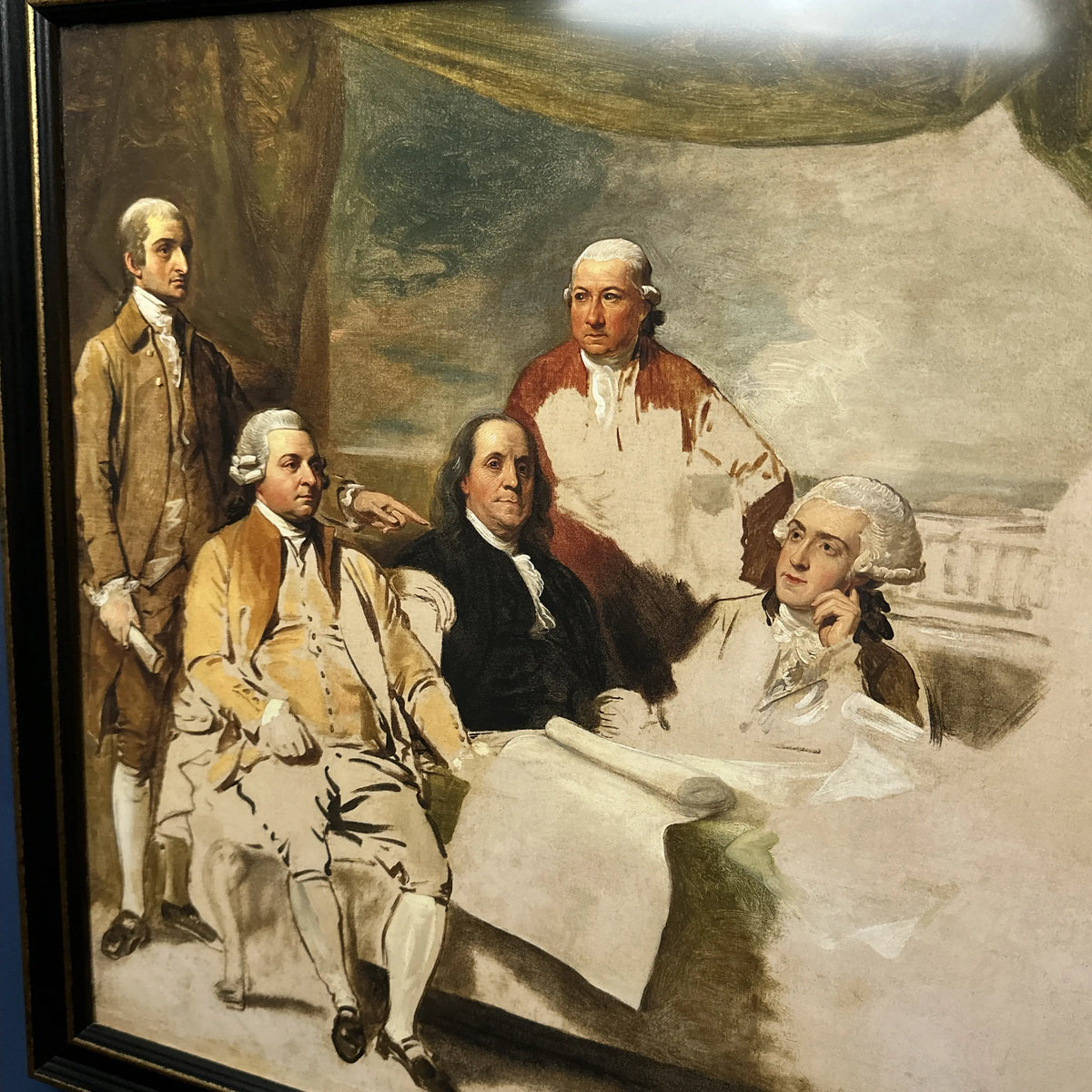
1783 “Treaty of Paris” painting by Benjamin West — Archival print produced under license
Has the additional information we publish here every morning been interesting? I’d be happy to get your feedback and suggestions. — Lee Wright | Founder
Campfire
Enduring symbol of liberty. Ordered in 1751 from a foundry in England to commemorate the 50-year anniversary of William Penn’s 1701 Charter of Privileges, Pennsylvania’s original Constitution. Cracked the first time it was rung. Melted down and recast twice. A replacement was ordered and they tried to return the original. Wasn’t rung on July 4, 1776. It may have been rung on July 8 when the Declaration was read publicly. Removed from Philadelphia and hidden under the floorboards of a church in Northampton Town (now Allentown) during the British occupation. First called the “Liberty Bell” in 1835 in an anti-slavery publication. Seen by nearly a quarter of the nation’s population during a 1915 tour to 275 cities and towns. “Proclaim LIBERTY Throughout all the Land unto all the Inhabitants Thereof”
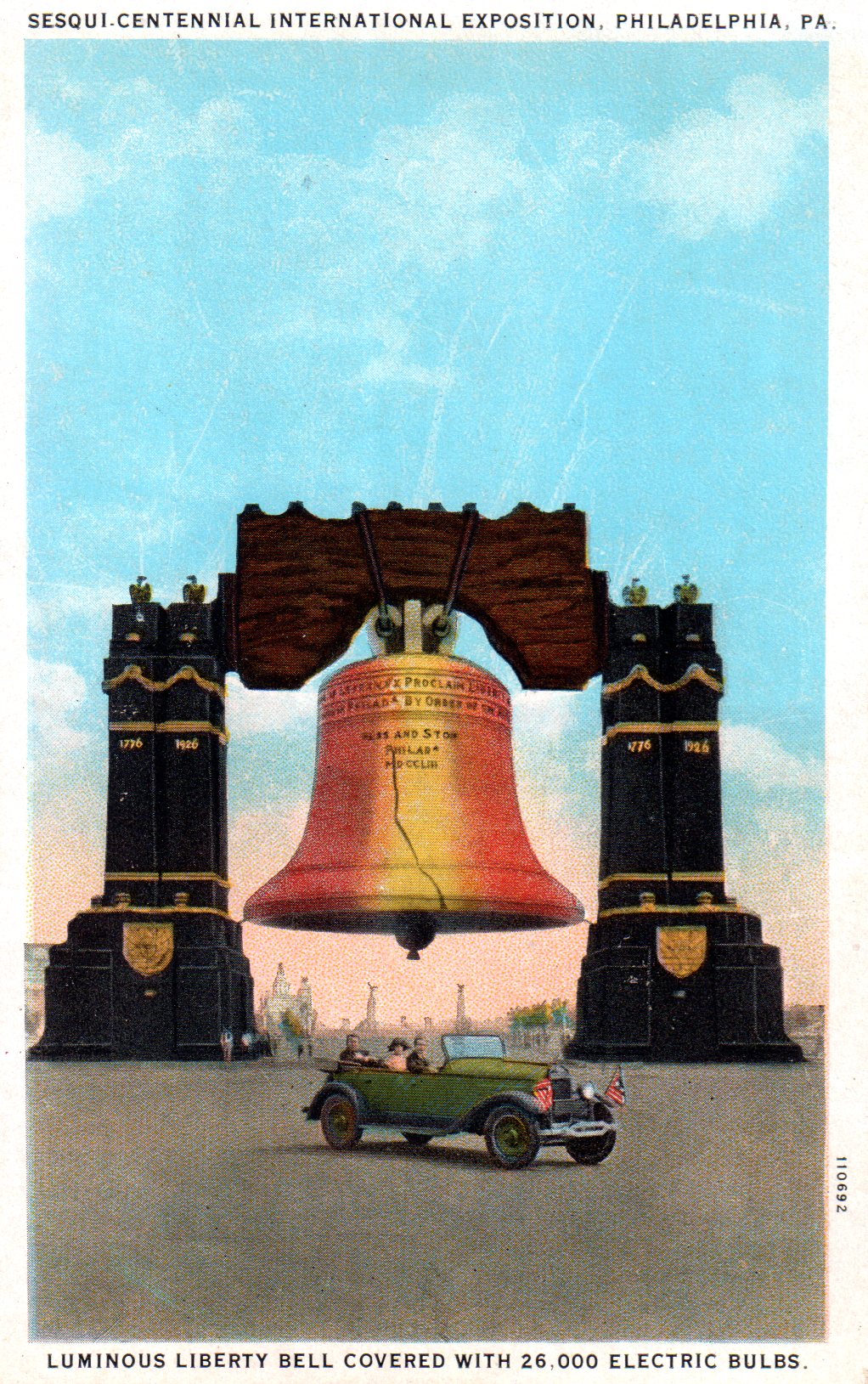
Pictured: The 80-foot tall “Luminous Liberty Bell” spanning Broad Street (at Johnson St), Philadelphia, PA, built in 47 days by Frank C. English & Sons in April-May, 1926, at a cost of $100,000 for the 1926 Sesqui-Centennial International Exposition. The bell was illuminated with 26,000 15-watt light bulbs set at six-inch centers and eight 200-watt projectors in the clapper. The structure contained 80 tons of steel resting on a foundation of 30-foot wooden pilings with a concrete capping.
(Austin, E.L. and Odell Hauser. “The Sesqui-Centennial International Exposition”. Philadelphia: Current Publications, Inc. 1929, p. 67)
Related products

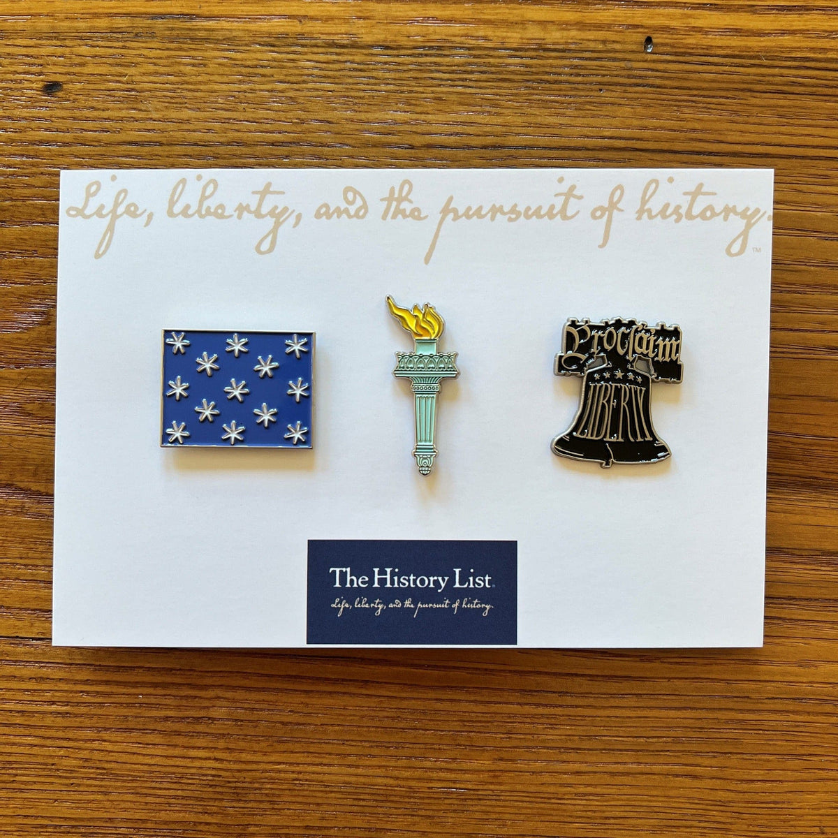
Embroidered “Proclaim Liberty” cap with the Liberty Bell and “Proclaim Liberty” Pin Set
Has the additional information we publish here every morning been interesting? I’d be happy to get your feedback and suggestions. — Lee Wright | Founder
Mary Katherine Goddard's broadside, the first with names of the signers

“On January 18, 1777, Congress convened in Baltimore and ordered the second printing by Mary Katharine Goddard. This edition is outstanding as the only Declaration titled The Unanimous Declaration of the Thirteen United States of America, having been printed after New York had finally cast its vote to form the thirteenth state, and as the very first printing to publicly reveal the names of all the members of the Second Continental Congress.”
Source: Intima Press
“The Declaration of Independence that [Mary Katherine Goddard] printed in Baltimore in January 1777 was the first version of the document to list the names of most of the signers. Goddard risked her life and her livelihood by including her own name on the Declaration of Independence.
“Born in New London, Connecticut in 1739, Goddard learned the printing business from her younger brother William. Goddard followed William from New London to Providence and on to Philadelphia. William started the Pennsylvania Chronicle newspaper in 1767, and the Goddard family used a Franklin-owned press in a Franklin-owned house during at least part of their time printing and publishing in Philadelphia.
“The Goddards relocated to Baltimore, and William started that city’s first newspaper in 1773, the Maryland Journal and the Baltimore Advertiser. After about a year, Mary Katharine Goddard took over the printing business while her brother traveled the colonies to promote the “Constitutional Post,” an alternative to the royal postal system. Named postmaster of Baltimore in July 1775, she became the first postmaster of Baltimore, the first female postmaster in the colonies, and eventually the first female postmaster in the United States. Around the same time, she stopped printing the Maryland Journal under her brother’s name and began printing under “M.K. Goddard.”
“In December 1776, the Continental Congress relocated to Baltimore, just blocks from Goddard’s printing office/bookstore/post office. As the official printer to the Continental Congress and a proud supporter of the American cause, she printed Congressional resolutions and notices as well as the Declaration of Independence with the names of the signers. Goddard’s imprint at the bottom of the document identifies not only the city where she worked for so many years, but also her full name: “Baltimore, in Maryland: Printed by Mary Katharine Goddard.”
From the National Park Service
Learn more
View the version Goddard printed on the site of the New York Public Library.
Related product
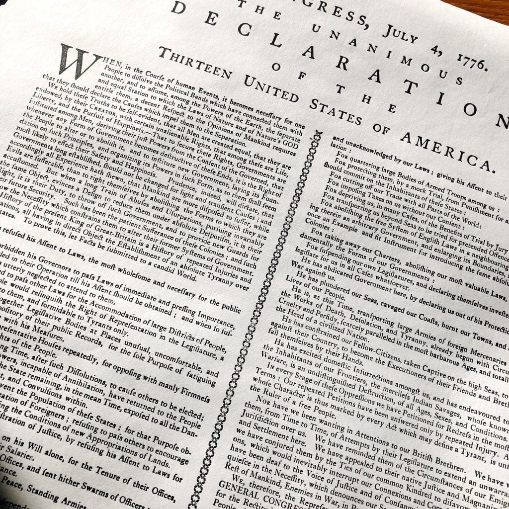
“Declaration of Independence” printed by Mary Katherine Goddard (Baltimore)
Has the additional information we publish here every morning been interesting? I’d be happy to get your feedback and suggestions. — Lee Wright | Founder
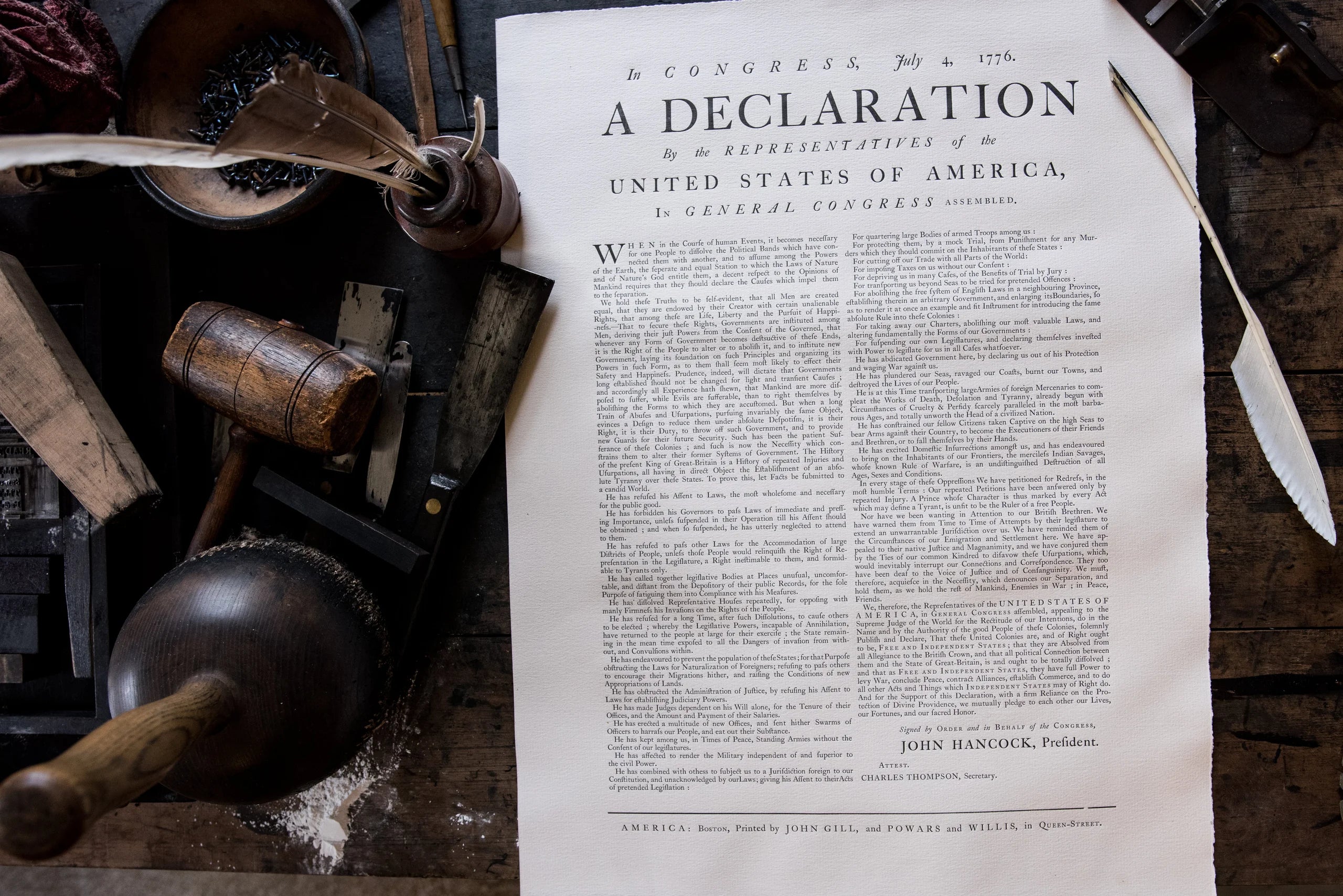
As the Dunlap broadside was sent throughout the colonies, local printers set their own versions. This is the Boston Broadside.
“Edward Eveleth Powars and Nathaniel Willis printed the Declaration of Independence in their Boston newspaper, the New-England Chronicle, on July 18, 1776. But they also created a broadside of the text in collaboration with John Gill, a printer whose twenty-year partnership had been severed by the first shots of the Revolutionary War.
“Benjamin Edes and John Gill had printed the Boston Gazette together beginning in April 1755. Their final joint issue was twenty years later on April 17, 1755—two days before the Battles of Lexington and Concord. The masthead of their newspaper featured a depiction of Britannia, the personification of the mother country, holding a pole topped by a liberty cap in one hand and opening a bird cage with the other. This woodcut was created by Paul Revere, one of the riders who famously alerted people to the advancing British forces on the night of April 16.
“Benjamin Edes took their printing press and continued to publish the Boston Gazette on his own beginning in June 1775. He used the same masthead and title. But Edes was not actually in Boston anymore. He printed the Boston Gazette in nearby Watertown. But the British imprisoned John Gill. In September 1775, Edes printed a list in the Gazette of people who had been jailed in Boston. The list included both his son, Peter, and his former partner, John Gill. Peter Edes was charged with having firearms concealed in his house. Meanwhile, British officials accused Gill of “printing Treason, Sedition, and Rebellion.” The news of his imprisonment, first printed in Edes’s Boston Gazette, was published in other newspapers.
From Emily Sneff’s Declaration Stories, which has more information on the Boston broadside.
Learn more
Scroll down this page for a video of Gary Gregory printing the Boston Broadside.
Learn more
Watch the Declaration being printed and includes additional information on the history of the Declaration and of printing.
Related product
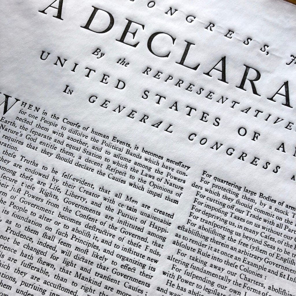
“Declaration of Independence” Boston Broadside from the Printing Office of Edes & Gill
Has the additional information we publish here every morning been interesting? I’d be happy to get your feedback and suggestions. — Lee Wright | Founder
Dunlap Broadside (First Printing of the Declaration of Independence)
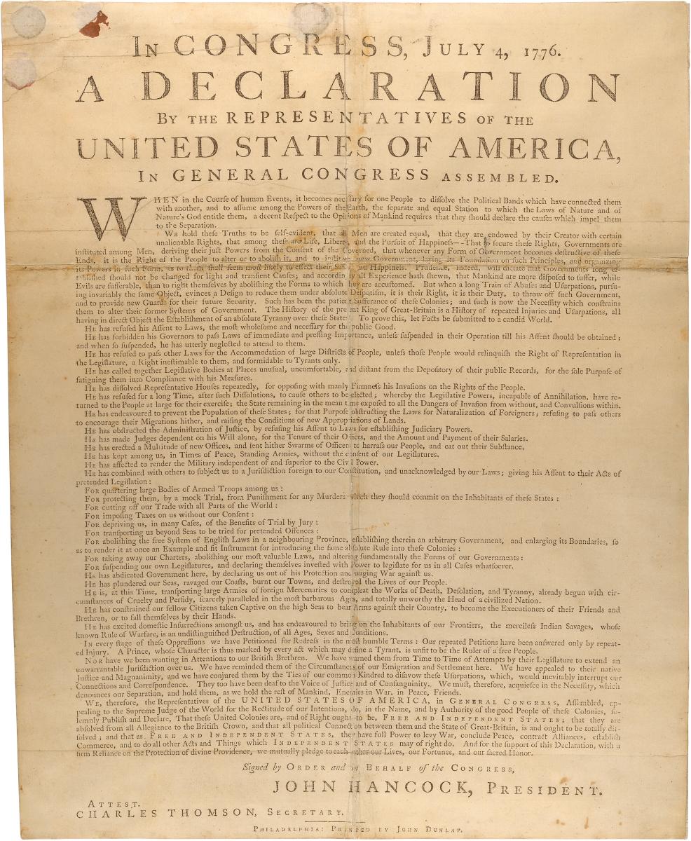
The Library of Congress describes the printing of the Declaration this way:
“John Dunlap, official printer to the Continental Congress, produced the first printed versions of the American Declaration of Independence in his Philadelphia shop on the night of July 4, 1776. After the Declaration had been adopted by the Congress earlier that day, a committee took the manuscript document, possibly Thomas Jefferson’s ‘fair copy’ of his rough draft, to Dunlap for printing. On the morning of July 5, copies were dispatched by members of Congress to various assemblies, conventions, and committees of safety as well as to the commanders of Continental troops. Also on July 5, a copy of the printed version of the approved Declaration was inserted into the “rough journal” of the Continental Congress for July 4. The text was followed by the words ‘Signed by Order and in Behalf of the Congress, John Hancock, President. Attest. Charles Thomson, Secretary.’ It is not known how many copies of what came to be called ‘the Dunlap broadside’ were printed on the night of the fourth. Twenty-five copies are known to exist: 20 owned by American institutions, two by British institutions, and three by private individuals. Shown here is a copy from the U.S. National Archives and Records Administration.”
According to the Smithsonian’s National Museum of American History:
“Printing the Declaration was essential for the distribution of its meaning, and potential ramifications, across the Thirteen Colonies. The Declaration announced that the Thirteen Colonies were formally to be considered “thirteen united States of America” (later the United States). Within days of completion and approval of the handwritten document, and after its printed reproduction and dissemination to Congressional delegates in Philadelphia, copies were sent to printers across the states. This distribution allowed those printers to compose type and print hundreds of additional copies of the words of the Declaration for their own general publics.
“John Dunlap and Benjamin Towne made some of the first printings of the Declaration, probably because of their proximity to the Congressional meetings in Philadelphia. Dunlap is documented as the first printer to print a broadside flyer including the text of the Declaration. He printed 200 copies of his broadside on July 4, 1776, the day the Declaration’s wording was approved. Towne produced the first printing of the words of the document in the July 6 edition of his newspaper, the Pennsylvania Evening Post, just two days after they were penned.
“Close to forty contemporary versions of the Declaration are known to have been produced by printers, either in a newspaper or as a broadside. Printers in Great Britain produced the words of the document beginning in mid-August. Other countries, mainly western European, likely heard news of the Declaration by the end of the year.
“Disinterest in a revolution may have dissuaded printers in four states (Delaware, Georgia, New Jersey, and North Carolina) from reproducing the words of the Declaration in their newspapers. More than half of the colonists in what became the United States were opposed to separating from Great Britain. Even so, the sentiment of the Declaration was disseminated widely and became an inspiration to many Americans as well as international publics with antiestablishment and revolutionary thinking.
“During the time of the American Revolution, information was distributed primarily through word of mouth. About half of the male population of the Thirteen Colonies was illiterate. As such, public readings could spread the words and sentiments of the Declaration far more easily and faster than a personal reading of a handwritten or printed document.”
The Pennsylvania Center for the Book has this brief biography of Dunlap
“John Dunlap was born in Tyrone, County Strabane, Ireland, in 1747. On February 4, 1773, Dunlap was married to Elizabeth Hayes Ellison.
“In 1757, Dunlap was sent to Philadelphia as an apprentice to his uncle, printer-bookseller William Dunlap. In 1766, his uncle sold his stock of books and put his printing house in care of his nephew in order to pursue religious studies. Two years later, William Dunlap became an Anglican priest and took charge of the parish of Stratton in King and Queen County, Virginia, and sold his shop and equipment to John. John paid off his debt to his uncle in installments. Dr. Benjamin Rush, a close friend, reported that John was so poor he lived in his shop, sleeping on the floor under his counter.
“John supported himself by printing sermons, handbills, and pamphlets. In 1771, Dunlap began publishing the weekly Pennsylvania Packet or The General Advertiser. By 1775, Dunlap’s Packet was competing successfully. In 1776, Dunlap became an official printer to the government. As a result of this appointment, Dunlap became the first person to print the Declaration of Independence. However, Dunlap’s Packet did not get the distinction of being the first publisher. On July 6, Benjamin Towne preempted Dunlap and published the Declaration of Independence in his newspaper, the Pennsylvania Evening Post.
“By combining public pursuits with his printing business, Dunlap was able to establish a substantial fortune. An astute businessman, soldier (elected to the rank of first lieutenant in Philadelphia’s historic Light Horse in 1781), politician, and speculator, Dunlap’s determination and clout secured him fame as the founder of the nation’s first successful daily newspaper. Despite his wealth and numerous accomplishments, his friend Dr. Rush revealed of Dunlap, “In his family he was less amiable and respectable than in society. Towards the close of his life he became intemperate so as to fall in the street.”
“Dunlap died of apoplexy on November 27, 1812.”
Learn more
View one of the Dunlap broadsides on the website of the National Archives
Related product

“Declaration of Independence” printed by John Dunlap (Philadelphia)
Has the additional information we publish here every morning been interesting? I’d be happy to get your feedback and suggestions. — Lee Wright | Founder
Printing Press
From an interview with author Todd Andrlik following publication of his excellent book, Reporting the Revolutionary War: Before it was History, it was News, published on the Mount Vernon site.
“Newspapers were absolutely pivotal in making America. As the only mass media at the time, they fanned the flames of rebellion, sustained loyalty to the cause and ultimately aided in the outcome. Dr. Benjamin Rush wrote to General Nathaniel Greene during the Revolutionary War that a newspaper ‘in the present state of affairs would be equal to at least two regiments.’ Contemporary historian David Ramsay, who twice served as a delegate in the Continental Congress, wrote that “in establishing American independence, the pen and the press had merit equal to that of the sword.” By allowing the general public unprecedented access to the original papers, this book lets us learn firsthand what many modern historians claim: Without newspapers, there would have been no American Revolution.
“Were newspapers of the Revolutionary War era much different from their modern counterparts today?
“Newspapers of the Revolution are quite different from newspapers today yet they share some similarities. Dimensions of 18th century newspapers were a tad smaller than modern tabloids with a menu of content consisting of advertising, local and world news, legal notices, essays and more. However, keep in mind that this was before photos, before headlines and before standardized English.
“The average circulation of the top 100 newspapers today is 200,000. In 1775, the average circulation was 600, but papers benefited from an amplified reach because they were often read aloud in meeting houses, coffee houses, taverns and private homes. Today, news is on demand and practically streaming in real time.
“Back then, newspapers were printed once a week. A 1776 newspaper tended to be only four pages long and was crammed with content that was days or weeks old, depending on how far the news had to travel on horseback or by ship. Still, the British Empire’s newspaper network was the fastest way of spreading news that the nation had ever seen, and the news was considered fresh when it arrived because it was the latest information colonists had.”
Learn more
Watch a demonstration of the common press identical to those used in 1776:
https://whattheythink.com/video/128626-dont-shoot-until-you-see-whites-their-press-sheets/
The National Park Service has an interesting article on printmaking, images, not documents with type that had been set: https://www.nps.gov/articles/000/printmaking-in-the-american-colonies.htm
Related product
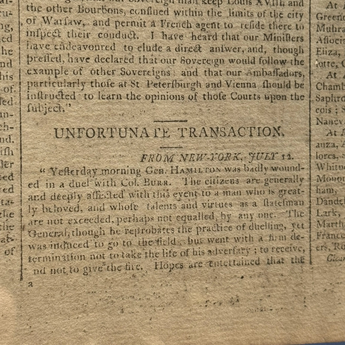
We’ve offered papers from that period and later in our Rare Finds. For example, this July 16, 1804 Boston Gazette carried a report from New York dated July 12 of the dual that led to the death of Alexander Hamilton. It was under the headline, “UNFORTUNATE TRANSACTION.”
Has the additional information we publish here every morning been interesting? I’d be happy to get your feedback and suggestions. — Lee Wright | Founder
Fireworks
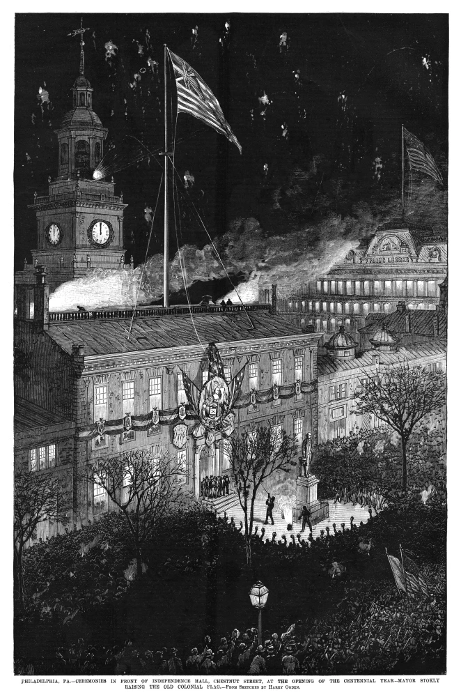
The image is from Frank Leslie’s Illustrated Newspaper of January 22, 1876 and is entitled, Ceremonies in front of Independence Hall, Chestnut Street, at the opening of the centennial year – Mayor Stokley raising the old colonial flag
The Constitution Center has this explanation of why we celebrate July 4 despite the fact that Congress voted on July 2 to delare independence:
“Officially, the Continental Congress declared its freedom from Great Britain on July 2, 1776, when it voted to approve a resolution submitted by delegate Richard Henry Lee of Virginia, declaring “That these United Colonies are, and of right ought to be, free and independent States, that they are absolved from all allegiance to the British Crown, and that all political connection between them and the State of Great Britain is, and ought to be, totally dissolved.”
“John Adams thought July 2 would be marked as a national holiday for generations to come:
‘[Independence Day] will be the most memorable Epocha, in the History of America. I am apt to believe that it will be celebrated, by succeeding Generations, as the great anniversary Festival… It ought to be solemnized with Pomp and Parade with shews, Games, Sports, Guns, Bells, Bonfires and Illuminations from one End of this continent to the other from this Time forward forever more,’ Adams wrote.
“After voting on independence on July 2, the Continental Congress then needed to draft a document explaining the move to the public. It had been proposed in draft form by the Committee of Five (John Adams, Roger Sherman, Robert Livingston, Benjamin Franklin, and Thomas Jefferson) and it took two days for the Congress to agree on the edits.
“Once the Congress approved the actual Declaration of Independence document on July 4, it ordered that it be sent to a printer named John Dunlap. About 200 copies of the ‘Dunlap Broadside’ version of the document were printed, with John Hancock’s name printed at the bottom. Today, 26 copies remain.
“That is why the Declaration has the words, “IN CONGRESS, July 4, 1776,” at its top, because that is the day the approved version was signed in Philadelphia.
“On July 8, 1776, Colonel John Nixon of Philadelphia read a printed Declaration of Independence to the public for the first time on what is now called Independence Square. . . .
“The late historian Pauline Maier said in her 1997 book, American Scripture: Making the Declaration of Independence, that no member of Congress recalled in early July 1777 that it had been almost a year since they declared their freedom from the British. They finally remembered the event on July 3, 1777, and July 4 became the day that seemed to make sense for celebrating independence.
“Maier also said that arguments over the how to celebrate the Declaration arose between the Federalists (of John Adams) and the Republicans (of Thomas Jefferson) and that the Declaration and its anniversary day weren’t widely celebrated until the Federalists faded away from the political scene after 1812.
“In an 1826 letter – the last he ever wrote — Thomas Jefferson spoke of the importance of Independence Day. “For ourselves, let the annual return of this day forever refresh our recollections of these rights, and an undiminished devotion to them,” he said.
“Jefferson and Adams both passed away two days later, on the Fourth of July.
Has the additional information we publish here every morning been interesting? I’d be happy to get your feedback and suggestions. — Lee Wright | Founder
John Hancock
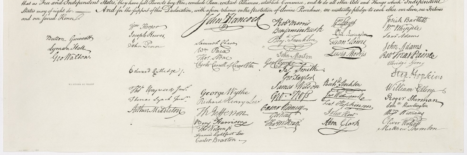
John Hancock was president of the Second Continental Congress, and in the Trumbull painting, he’s sitting at the desk where the Committee of Five is presenting their draft. As President, John Hancock’s is the only name listed on the broadside that was printed by John Dunlap and distributed the morning of July 5. It wasn’t until January 18, 1777 when Mary Katharine Goddard in Baltimore published the first “official” version that the names of most delegates were made public.
John Hancock was central to one of the best-known stories of the Revolution, Paul Revere’s ride. On the evening of April 18, 1775, John Hancock and Samuel Adams, having attended the Massachusetts Provincial Congress in Concord and wary of returning to Boston, were guests of Rev. Clarke. Fearing that they might be captured by the British, Dr. Joseph Warren of Boston dispatched William Dawes and Paul Revere to Lexington with news of the advancing British troops. Arriving separately, they stopped to warn Hancock and Adams around midnight, then set off for Concord. Hancock and Adams made their way to Burlington to avoid capture.
Learn more
You can visit the Hancock-Clarke House in Lexington, Massachusetts.
Related products

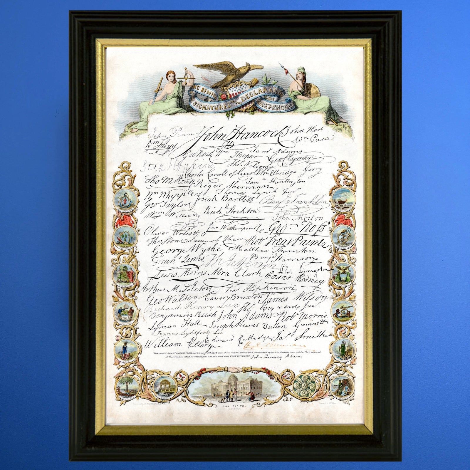

Historic “Declaration of Independence” engraving by publisher John Binns Archival print, All the Signatures of the Signers to the Declaration of Independence — Archival print, and “The Signers of the Declaration of the Independence and their signatures” Small poster
Has the additional information we publish here every morning been interesting? I’d be happy to get your feedback and suggestions. — Lee Wright | Founder
Presenting the draft

The painting by John Trumbull is sometimes incorrectly described as depicting the signing of the Declaration of Independence. The painting shows the five-man drafting committee presenting their draft of the Declaration to the Congress, an event that took place on June 28, 1776, and not the signing of the famous copy, which took place mainly on August 2.
The painting shows 42 of the 56 signers of the Declaration. Trumbull originally intended to include all 56 signers but was unable to obtain likenesses for all of them. He also depicted several participants in the debate who did not sign the document, including John Dickinson, who declined to sign. Trumbull had no portrait of Benjamin Harrison V to work with, but his son Benjamin Harrison VI was said to resemble his father, so Trumbull painted him instead. Similarly, Trumbull painted Rufus Hopkins, who resembled his father Stephen Hopkins, for whom no portrait was available. As the Declaration was debated and signed o(Wver a period of time when membership in Congress changed, the men featured in the painting never were in the same room at the same time.
The painting is one of four by Trumbull mounted in the rotunda of the US Capitol. It is 12′ x 18′ The other three are Surrender of General Burgoyne, which depicts the British surrender at Saratoga; Surrender of Lord Cornwallis, which shows the British surrender at Yorktown; and, General George Washington Resigning His Commission, a scene from December 23, 1783, showing Washington relinquishing his military power.
John Trumbull (1756-1843) was the foremost painter of the American Revolution. He spent a brief period in the Continental Army as an aide-de-camp to General George Washington during the first year of the war. After a dispute over the date of his officer’s commission, Trumbull resigned from the army. Soon after, an opportunity arrived for him to travel to England to study art under the painter Benjamin West. (West painted Treaty of Paris, which we’ll see later.)
Trumbull worked on the Declaration of Independence for more than three decades, producing sketches and three versions. The earliest version is a small painting begun in 1786 acquired by Yale for their art gallery in 1832. Trumbull created the painting for the Rotunda of the U.S. Capitol in 1817-1818. In both these versions, Trumbull was inaccurate about some of the Assembly Room’s architectural elements such as the number and placement of doors and windows and created elaborate furnishings such as the coat of arms, the fancy furniture and window coverings. These were based on a sketch provided by Thomas Jefferson who appears to have had a faulty memory of the room’s actual features. This was corrected by the third version, painted in 1832, known as the Wadsworth version, no doubt in response to critics from Philadelphia.
Trumbull commissioned engraver Asher B. Durand for $3,000 to produce engravings, which were sold by Trumbull through a subscription in late 1823 for the costly sum of $20 and only about 300 were produced, which was a disappointment to Trumbull.
Sources: Smithsonian, Architect of the Capitol, Wikipedia, The New York Historical
Learn more
The Declaration Resources Project at Harvard has a large image of the painting and details about many of the men in it.
Related product

We offer the key to the engraving of the painting, which includes the signatures, as a small poster, as well as an archival print with the signatures of all of the signers.
Also available, Large archival print with the marked-up draft of the Declaration of Independence
Has the additional information we publish here every morning been interesting? I’d be happy to get your feedback and suggestions. — Lee Wright | Founder
Roger Sherman — Signed all documents
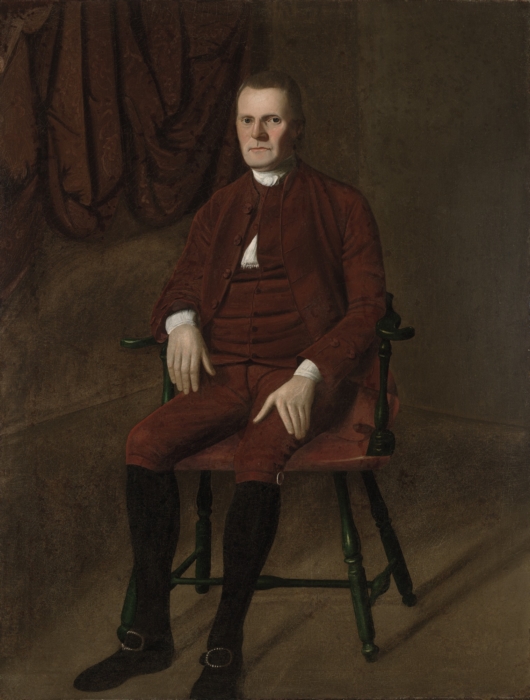
Roger Sherman was a member of the Committee of Five that drafted the Declaration of Independence. He is the only person to sign all four great state papers of the United States: the Continental Association, the Declaration of Independence, the Articles of Confederation, and the Constitution. He also signed the 1774 Petition to the King.
He went didn’t have formal education beyond grammar school, opened a cobbler shop after his father died. He later became the county surveyor and published several almanacs, and he studied for and passed the bar to become a lawyer. He went on to serve in local and statewide offices.
At the Constitutional Convention he proposed the Great Compromise, which established a bicameral Congress with proportional representation in the House and equal state representation in the Senate.
He was married two times and had a total of 14 children, with 12 reaching adulthood.
His second wife was a second cousin of Samuel Prescott, who rode with Paul Revere
And he is a distant relative of Union general William Tecumseh Sherman.
Learn more
The Constitution Center has a more detailed biography that includes his political views and his reaction to the events that ultimately led to to the Declaration.
Related product
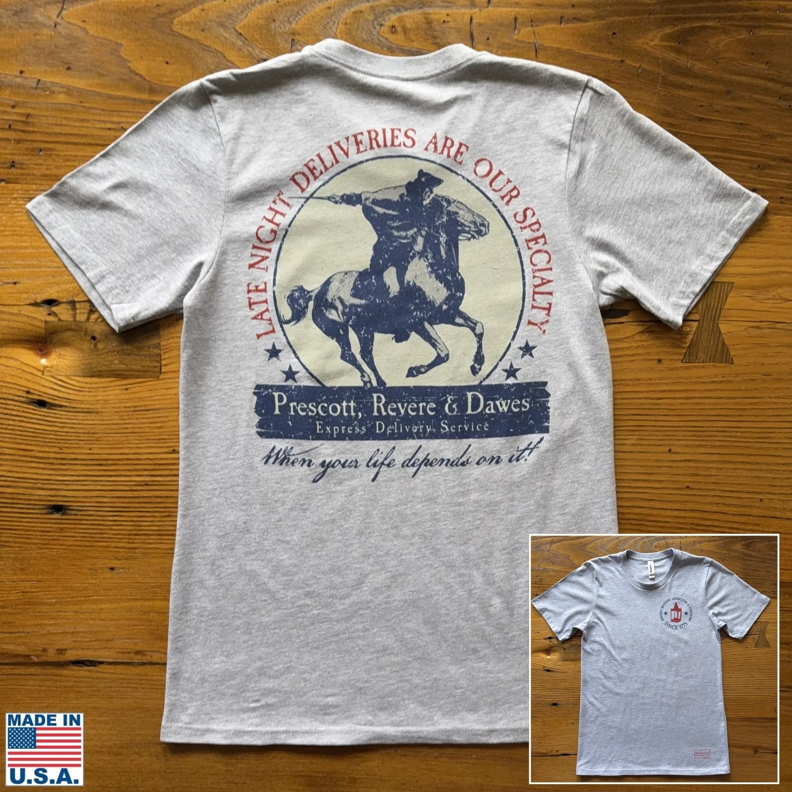
“Prescott, Revere, and Dawes Express Delivery Service” Made in America Shirt
Robert R. Livingston

Robert R. Livingston was a delegate from New York to both the first and second Continental Congress, and was a member of the committee of five charged with drafting the Declaration.
Later, Livingston played a pivotal role in that agreement that led to the Lousianna Purchase, as explained in this article from the American Battlefield Trust:
“During his three-year mission to France [which began in 1801] Livingston negotiated first for a free-trade treaty, which then morphed into an offer to buy New Orleans and southern Louisiana, and then finally evolved into the Louisiana Purchase which more than doubled the territorial size of the United States. Napoleon needed the money to fund his wars, and America wanted to keep the Mississippi River open to trade. The signing of the Louisiana Purchase took place on April 30, 1803. Robert Livingston called it “the noblest work of his life.” It prevented a war between the United States and France and secured a critical avenue for commerce and migration which still serves as a vital artery for commerce to this day.
Learn more
The Office of the Historian of the Department of State is one of many sources for more information about the Lousiana Purchase.
Related product
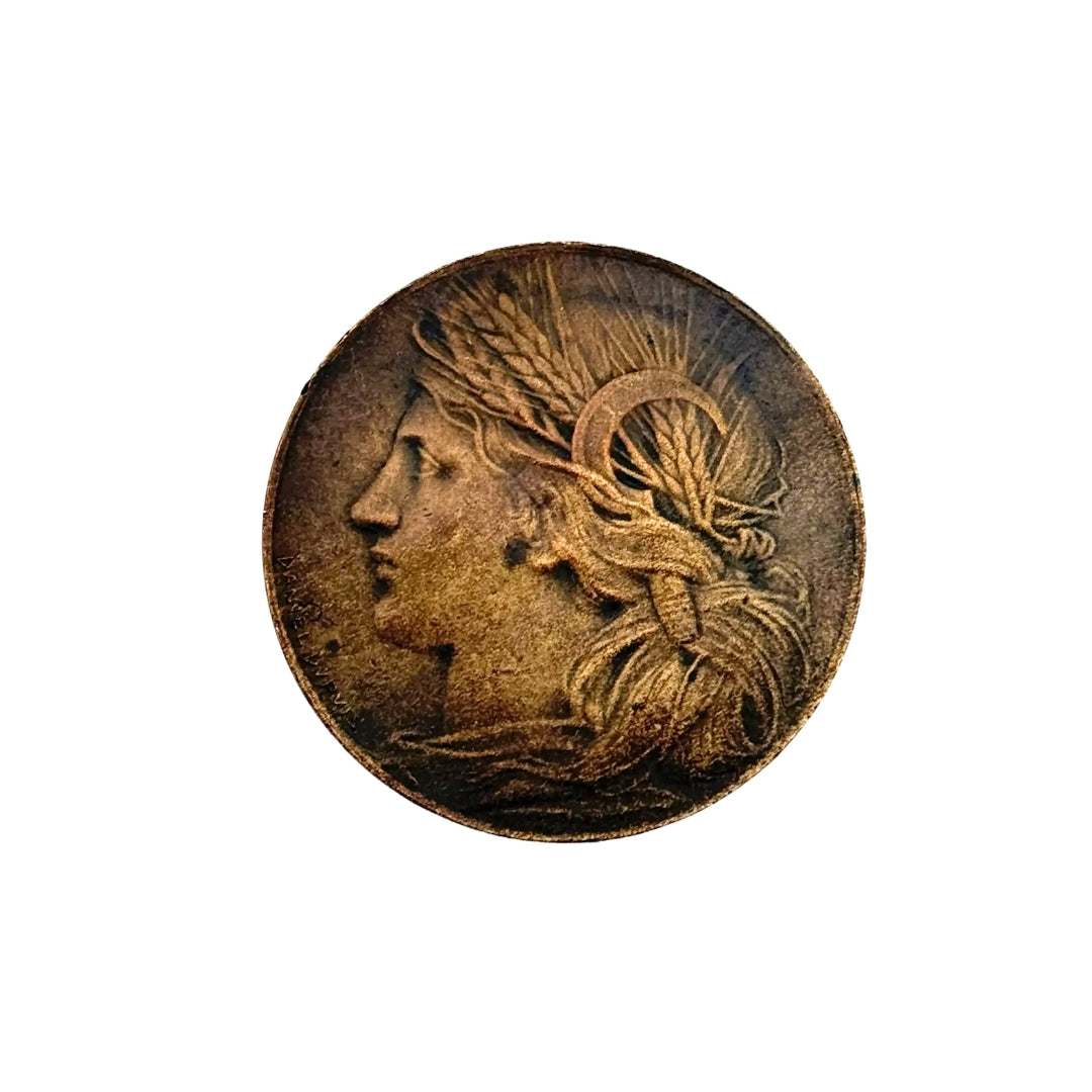
1904 Louisiana Purchase Exposition Bronze Commemorative Medal — Head of Ceres
Benjamin Franklin

Benjamin Franklin was one of the members of five-man committee charged with drafting the Declaration of Independence. He was also the oldest individual at the Continental Congress that summer. In addition to signing the Declaration, he later signed the Treaty of Paris (ending the war), and the U.S. Constitution—the only man to have signed all three.
His was a life of extraordinary accomplishment in so many areas, as is described in this excerpt from an article for American Experience:
“Born on January 17, 1706, to a poor English chandler (a candle and soap maker) living in Boston, Franklin was the 15th of 17 children. Franklin left school at 10 and began an apprenticeship in his brother’s print shop at 12. At 17 he ran away, first to Philadelphia, then to London, then back to Philadelphia, where he set up a print shop and began to publish The Pennsylvania Gazette.
A Man of Ideas and Inventions
“The creations and inventions of Franklin’s adult life are legendary and far-flung. He published the oft-quoted Poor Richard’s Almanack, established Philadelphia’s first public library, and created both America’s first volunteer firefighting company and the first fire insurance company. He opened the University of Pennsylvania, founded the American Philosophical Society for scientists, and obtained a charter to start America’s first hospital, the Pennsylvania Hospital. Around 1748 Franklin began his electricity research, establishing electricity and meteorology as viable fields of study. The list of his inventions included: bifocals; the medical catheter; the odometer; the Franklin stove (a wood burning stove that made home heating safer); and, of course, the lightning rod. Later, while in France, he pioneered the idea of daylight saving time, which moved an hour of daylight from morning to evening during summer months in order to save energy.
Politics and Diplomacy
“Having accumulated a modest fortune, Franklin retired at age 42 and turned to politics. Between 1766 and 1775, Franklin was Pennsylvania’s agent in London, where he testified before the British Parliament about the colony’s attitude toward the despised Stamp Act. He explained that colonists could tolerate duties to regulate commerce, but Parliament was not to levy internal taxes. The Stamp Act was repealed in 1766. After a brief return to America, where he served as a member of the Second Continental Congress, Franklin was dispatched to France to secure recognition of the new United States. Esteemed in America, he was revered in France. Shortly after Adams arrived in Paris, he wrote to Abigail Adams: ‘His name was familiar to government and people, to kings, courtiers, nobility, clergy, and philosophers, as well as plebeians, to such a degree that there was scarcely a peasant or citizen, a valet de chambre, coachman or footman, a lady’s chambermaid or a scullion in a kitchen, who was not familiar with it. … ‘ Women had taken to wearing a version of Franklin’s trademark bearskin cap, and his likeness was everywhere. Franklin was seen as the quintessential American, ascending from humble origins, imbued with the endearing qualities of ‘simplicity and innocence.’ Never mind that he had lived in London for 16 years. His super-star status served him well in his diplomacy.”
Learn more
This fact sheet lists the ages as well as the number of marriages and children, among other interesting things, of the signers.
This helpful timeline takes you through Franklin’s life and many accomplishments.
You can read the entire text of Franklin’s autobiography online or download it. (It’s also available as a printed volume.)
Finally, Ken Burns did a four-part series on Franklin that, as of this writing, you can stream online.
Related products


Our exclusive and original design HISTORY NERD® with Ben Franklin shirt, learn more about the life and works of Ben Franklin in a fun and creative way with the Franklin’s Fortune deck building game.
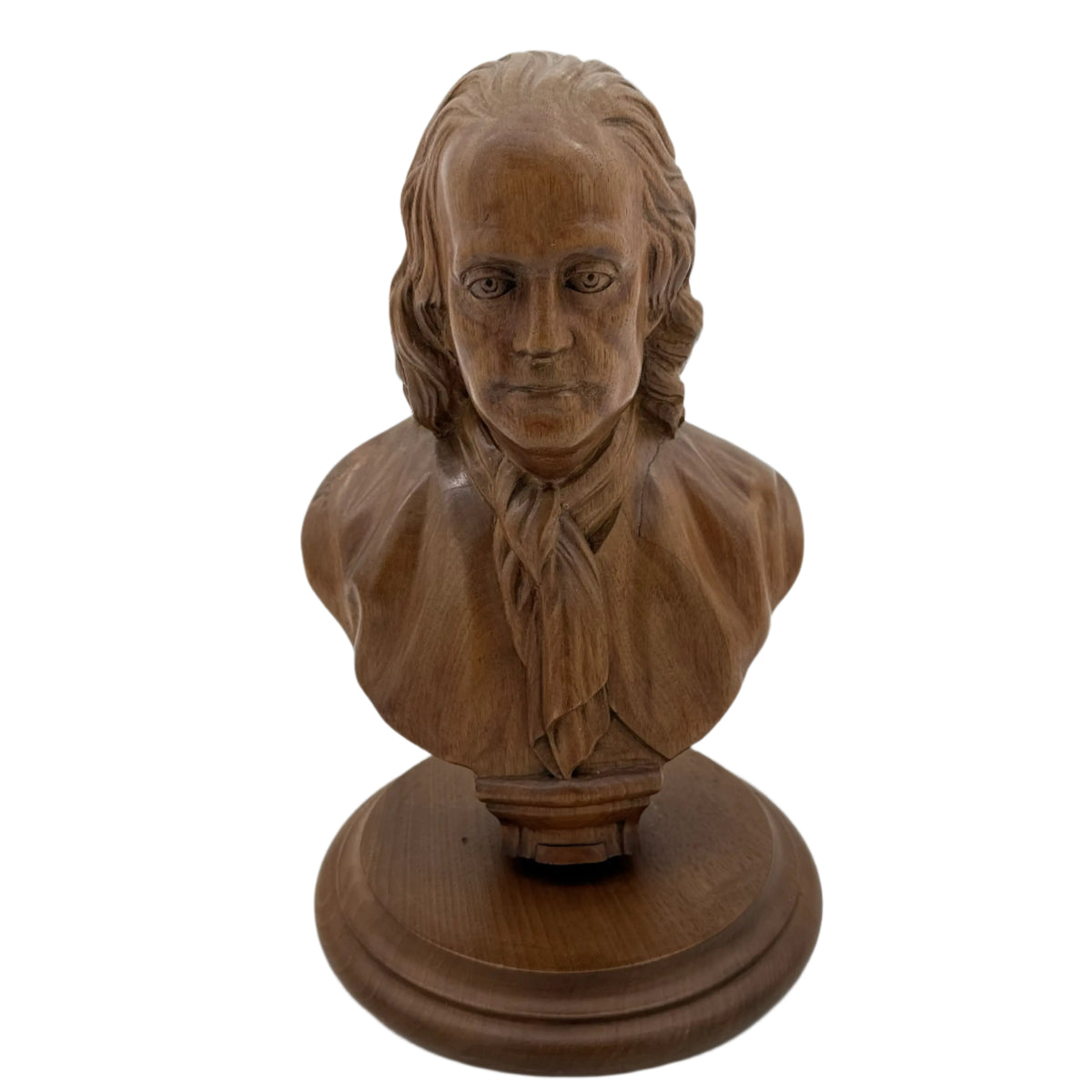
Also available, Wood carving bust of Franklin. Only one.
Ink Stand

The Syng inkstand was used during the signing of the United States Declaration of Independence in 1776 and the United States Constitution in 1787. It was made by Philip Syng in 1752 for the provincial assembly of Pennsylvania
Desktop inkstands hold ink for quill pens and other tools that require ink. Ornate versions include a pen holder, an inkpot, a candle to melt sealing wax, and a pot similar to a salt or pepper shaker used to pour pounce to aid in the sizing of parchment or vellum.
To prepare parchment or vellum for writing (sizing), you “pounce” it by sprinkling a fine powder like powdered gum sandarac, cuttlefish bone, or pumice onto the surface, gently rubbing it in with a cloth bag (pouncer), and then dusting off the excess to create a smooth, less absorbent surface that prevents ink from feathering and allows for crisp lines. This process seals the pores, making the surface receptive to ink, especially important for parchment/vellum, which is naturally absorbent.
Syng immigrated to America from Ireland in 1713. He was a renowned silversmith who created fine works in silver and gold for the wealthy families of Philadelphia. He was an associate of Benjamin Franklin and a prominent member of the Philadelphia community who assisted in founding the Library Company of Philadelphia, the American Philosophical Society, the Union Fire Company, and the University of Pennsylvania. In 1731, Syng served as Grand Master of Masons in Pennsylvania.
The Syng inkstand is one of four still-existing objects, paper documents aside, that were present during the Constitutional Convention, along with the Liberty Bell, the chair that George Washington sat in as the convention’s presiding officer, and Independence Hall itself.
Learn more
Watch a video of making and writing with a quill pen.
Related product
Beautiful archival print containing All the Signatures of the Signers to the Declaration of Independence as an archival print — Available framed or unframed
Thomas Jefferson

In an August 1822 letter to Timothy Pickering, also from Massachusetts, John Adams wrote about the forming of the Committee on June 11, 1776 to draft the Declaration and designating Thomas Jefferson to write the first draft.
“The Sub-Committee met; Jefferson proposed to me to make the draught. I said I will not; You shall do it. Oh No! Why will you not? You ought to do it. I will not. Why? Reasons enough. What can be your reasons? Reason 1st. You are a Virginian, and Virginia ought to appear at the head of this business. Reason 2d. I am obnoxious, suspected and unpopular; You are very much otherwise. Reason 3d: You can write ten times better than I can. ‘Well,’ said Jefferson, ‘if you are decided I will do as well as I can.’ Very well, when you have drawn it up we will have a meeting.”
Massachusetts Federalist Timothy Pickering was postmaster general of the United States from 1791 to 1795, secretary of war in 1795, and secretary of state from 1795 to 1800.
Related products from The History List store

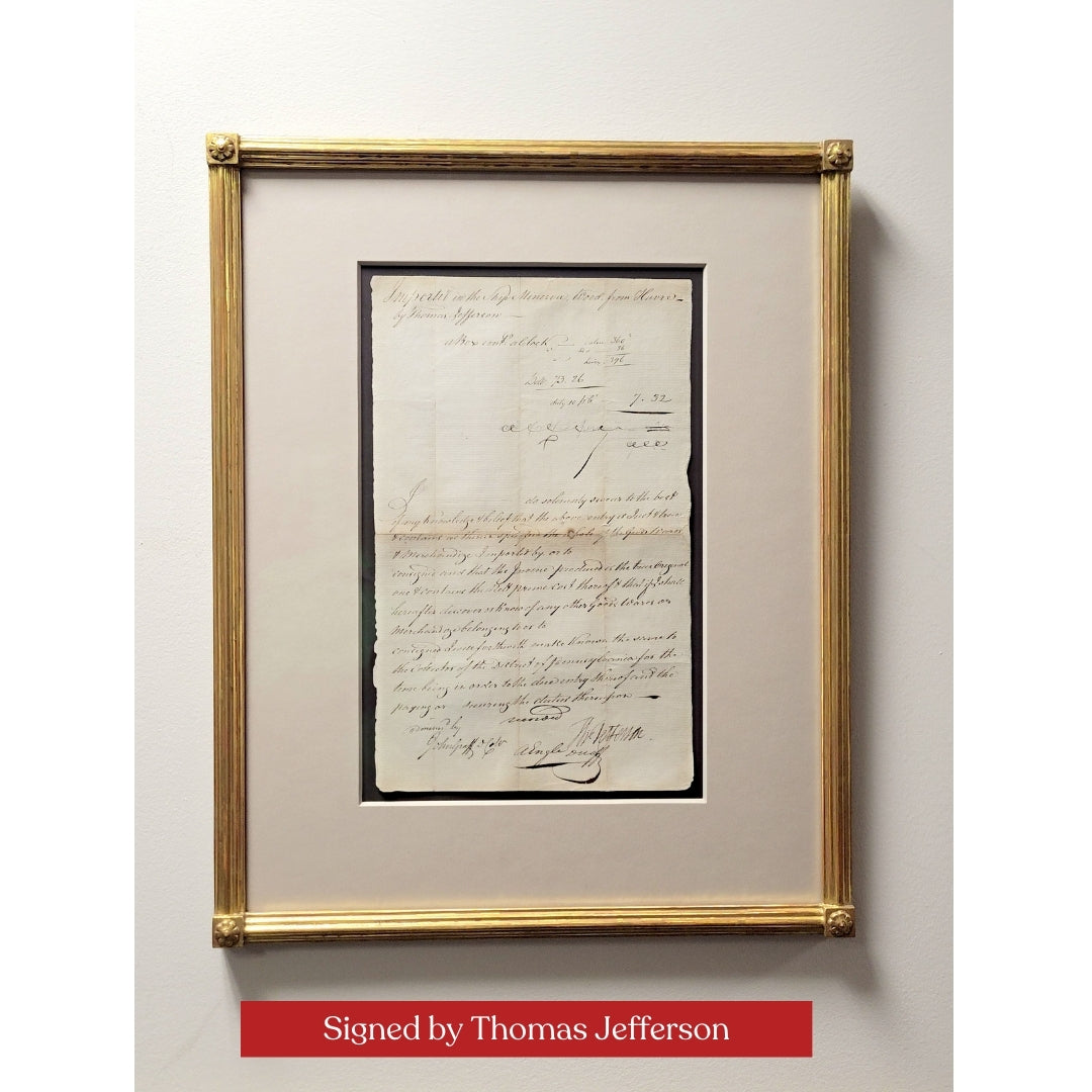
Ten “Revolutionary Superheroes” with Thomas Jefferson and Rare document signed by Thomas Jefferson from 1791
John Adams

The committee tasked with drafting the Declaration of Independence was the Committee of Five, appointed by the Second Continental Congress, consisting of Thomas Jefferson of Virginia, John Adams of Massach, Benjamin Franklin of Pennsylvania, Roger Sherman (Connecticut), and Robert Livingston (New York); Jefferson was chosen to write the first draft, with input and edits from the other members before it was presented to Congress for final approval.
In what would much later become a source of levity for history nerds, John Adams, writing to his wife from Philadelphia on July 3, was confident that July 2 would become the date celebrated every year:
“The Second Day of July 1776, will be the most memorable Epocha, in the History of America. I am apt to believe that it will be celebrated, by succeeding Generations, as the great anniversary Festival. It ought to be commemorated, as the Day of Deliverance by solemn Acts of Devotion to God Almighty. It ought to be solemnized with Pomp and Parade, with Shews, Games, Sports, Guns, Bells, Bonfires and Illuminations from one End of this Continent to the other from this Time forward forever more. You will think me transported with Enthusiasm but I am not. — I am well aware of the Toil and Blood and Treasure, that it will cost Us to maintain this Declaration, and support and defend these States. — Yet through all the Gloom I can see the Rays of ravishing Light and Glory. I can see that the End is more than worth all the Means. And that Posterity will tryumph in that Days Transaction, even altho We should rue it, which I trust in God We shall not.”
(Spelling from the original. “Epocha” is an archaic form of “epoch.”)
Why July 2? The Continental Congress declared freedom from Britain on July 2. They approved the Declaration of Independence on July 4.
As explained by The Constitution Center:
After voting on independence on July 2, the Continental Congress then needed to draft a document explaining the move to the public. It had been proposed in draft form by the Committee of Five (John Adams, Roger Sherman, Robert Livingston, Benjamin Franklin, and Thomas Jefferson) and it took two days for the Congress to agree on the edits.
Once the Congress approved the actual Declaration of Independence document on July 4, it ordered that it be sent to a printer named John Dunlap. About 200 copies of the “Dunlap Broadside” version of the document were printed, with John Hancock’s name printed at the bottom. Today, 26 copies remain.
That is why the Declaration has the words, “IN CONGRESS, July 4, 1776,” at its top, because that is the day the approved version was signed in Philadelphia.
On July 8, 1776, Colonel John Nixon of Philadelphia read a printed Declaration of Independence to the public for the first time on what is now called Independence Square.”
Learn more
Read the entire letter here.
Related products from The History List store
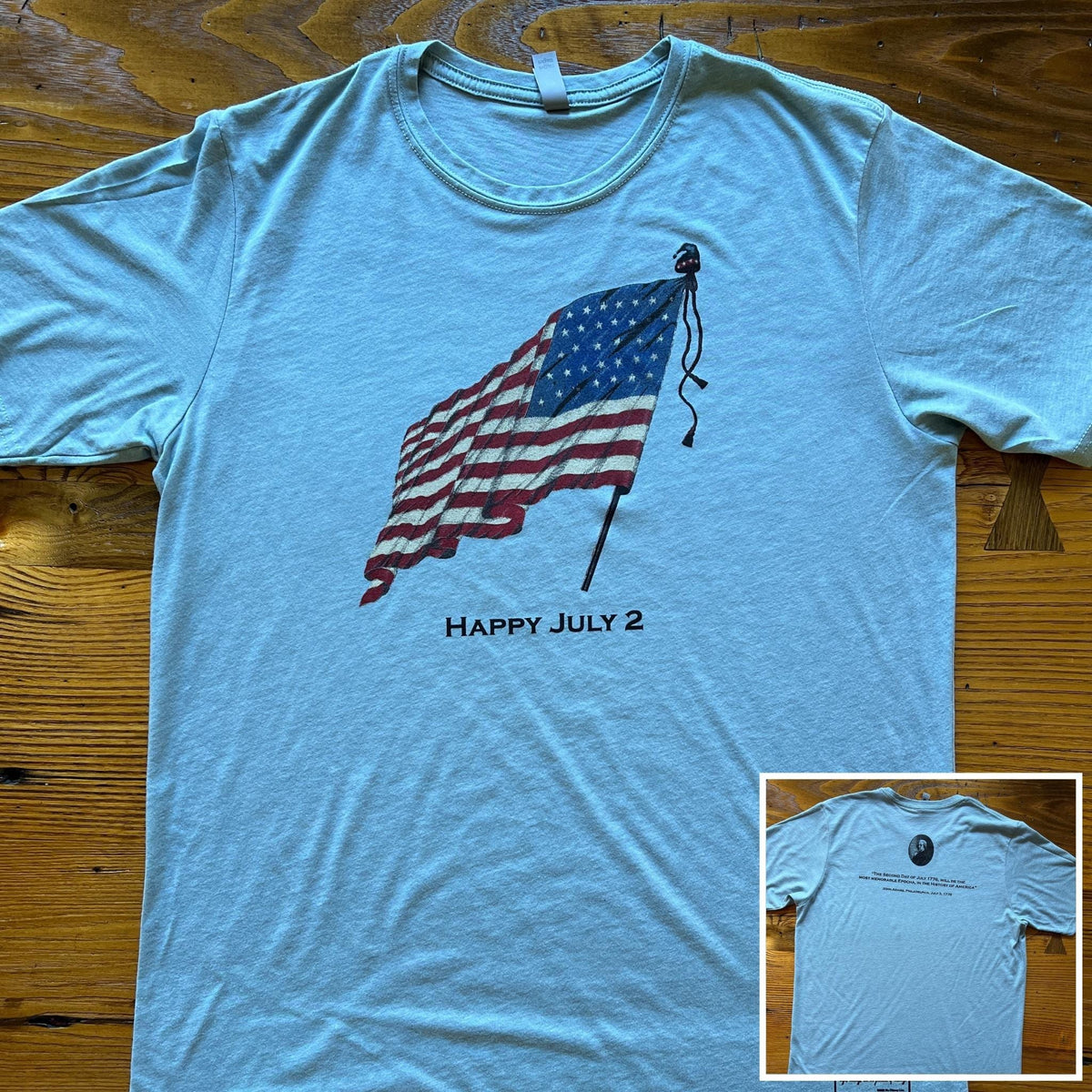
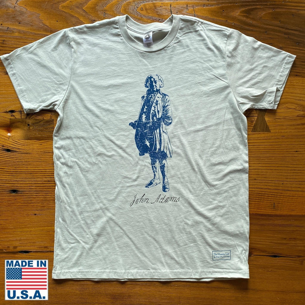
“Happy July 2” T-shirt with John Adams and his quote on the back and John Adams “Signature Series” Shirt
Interior of Independence Hall

What we refer to as Independence Hall was the Pennsylvania statehouse. The photo shows the Assembly Room, where the Declaration of Independence and U.S. Constitution were signed. This room originally housed the Pennsylvania Colonial Legislature.
Learn more
The National Park Service has a short video on Independence Hall, with more views of the interior, including several of the other rooms.
Related products from The History List store

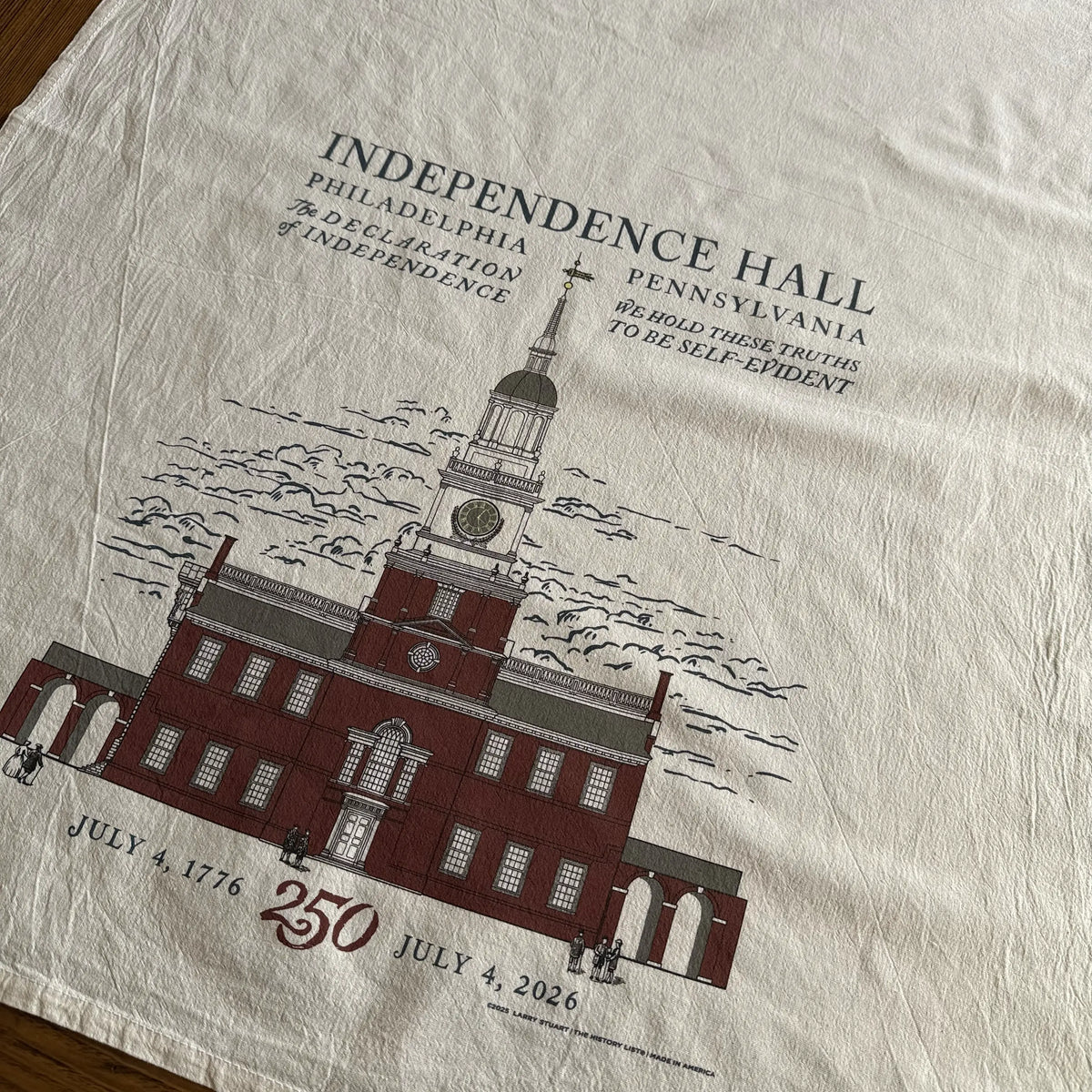
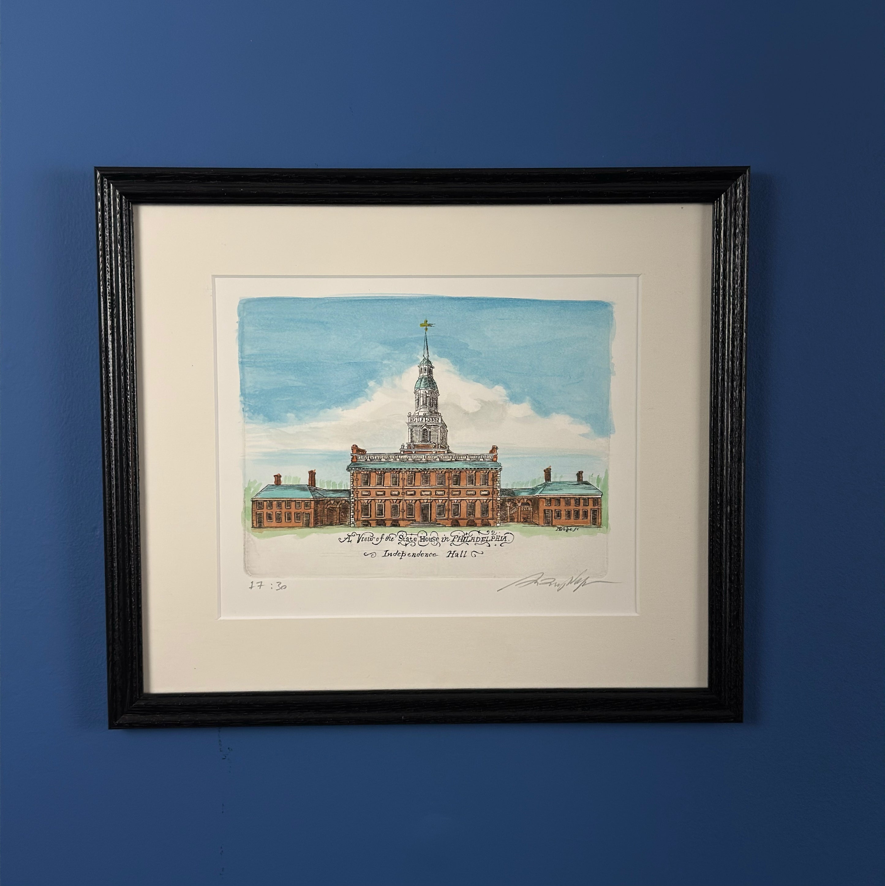
Our original designs featuring the Independence Hall on a Made in America Woven Blanket and Tea Towel. Also a hand-Engraved and hand watercolored framed print featuring the Independence Hall.
Grand Union flag (December 3, 1775)

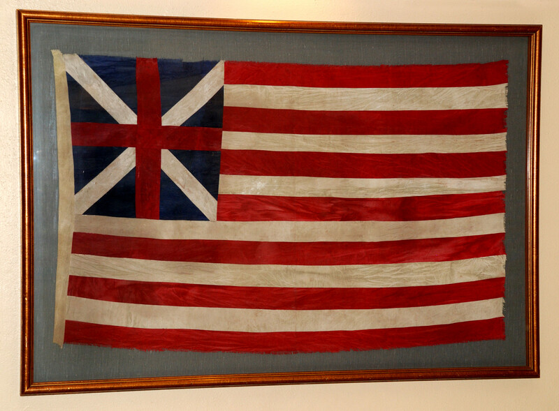
By the end of 1775, during the first year of the American Revolutionary War, the Second Continental Congress operated as a de facto war government authorizing the creation of an Army, a Navy and even a small Marine Corps. A new flag was needed to represent the Congress and fledgling nation, initially the United Colonies, with a banner distinct from the British Red Ensign flown from civilian and merchant vessels, the White Ensign of the British Royal Navy, and the British Union flags carried by the British Army’s men on land. Individual states had been using their own independent flags with Massachusetts using the Taunton Flag and New York using the George Rex Flag prior to the adoption of the Grand Union Flag.
The U.S. colonists’ (Continental Colour) was first hoisted on the colonial warship Alfred, in the harbor on the western shore of the Delaware River at Philadelphia, Pennsylvania on December 3, 1775, by newly-appointed Lieutenant John Paul Jones of the formative Continental Navy. The event had been documented in letters to Congress and eyewitness accounts. The flag was used by the U.S. Continental Army forces as both a naval ensign and garrison flag throughout 1776 and early 1777.
Learn more
Read the rest of the article The History of the Grand Union flag on The History List
Related products from The History List store

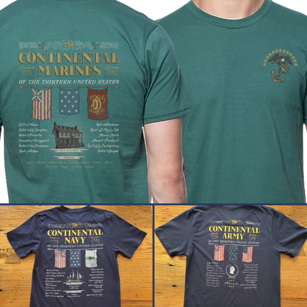
“We hold these truths – July 4, 1776” T-shirt and Continental Army, Navy, and Marines
George Washington

“In private letters, Washington thought himself unworthy of the monumental task he faced. Encountering Patrick Henry after the vote, Washington’s eyes filled with tears as he told his fellow Virginian ‘Remember Mr. Henry, what I now tell you: from the day I enter upon the command of the American armies, I date my fall, and the ruin of my reputation.’ Before speeding to Boston, Washington purchased several texts on organizing and leading large armies.”
George Washington was appointed Commander in Chief of the Continental Army by the Second Continental Congress on June 15, 1775. He formally accepted the commission on June 16 and was officially issued his commission on June 19, 1775.
Learn more
The text above is from the article “Appointment as Commander in Chief” article on the Mount Vernon website.
Related products from The History List store
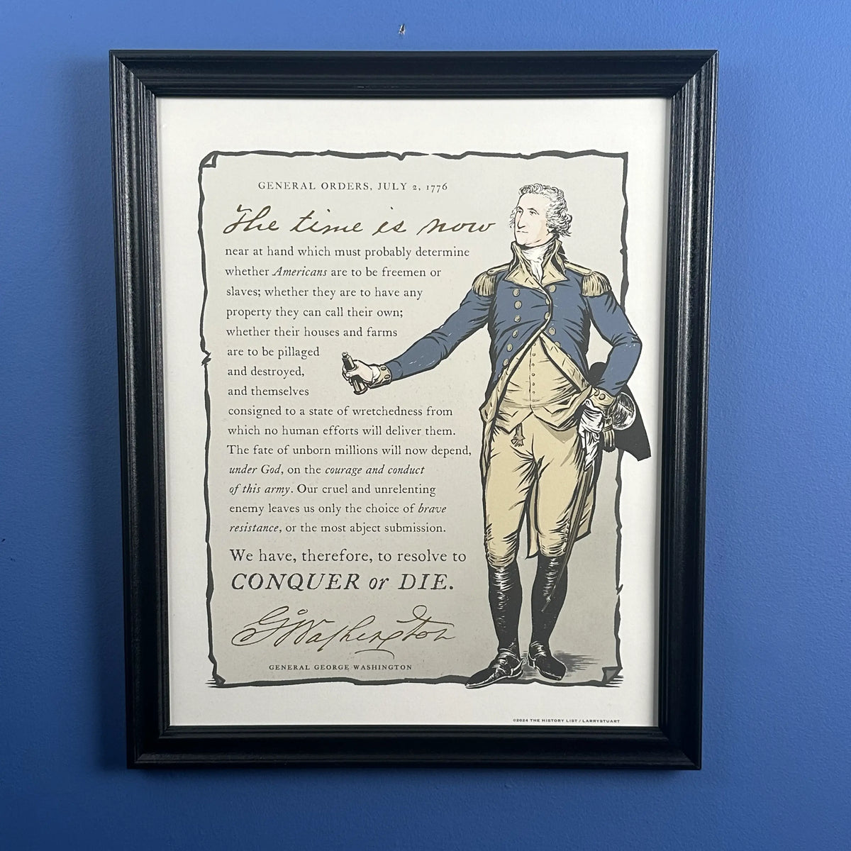
HISTORY NERD® shirt with George Washington and “Conquer or Die” — George Washington’s General Orders framed print made in America
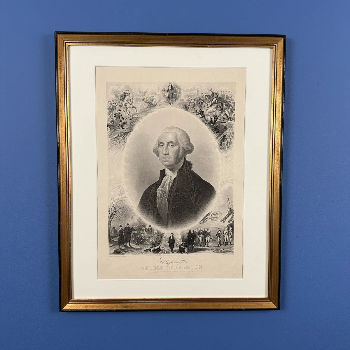
Also available, Washington print with scenes from his life — 1866 — Framed
Bunker Hill (June 17, 1775)

After shots were fired and men killed on both sides on April 19, it became obvious that the rupture in relations between the colonies the parliament and King in England was very serious. The Battle of Bunker’s Hill two months later drove this point home for both Patriots and Loyalists. The British suffered 1,054 casualties (226 dead and 828 wounded), the highest suffered by the British in any single encounter during the entire war. The British dead and wounded included 100 commissioned officers, which was a significant portion of the British officer corps in America. Much of General Howe’s field staff was among the casualties. General Clinton paraphrased Pyrrhus of Epirus, remarking in his diary that “A few more such victories would have shortly put an end to British dominion in America.”
And as shown in the illustration, the British burned Charlestown to the ground.
Learn more
In July of 2025 we held another History Camp Discussion with John and Sam covering the Battle of Bunker’s Hill and the siege and liberation of Boston. The video runs about an hour and ten minutes.
Related product from The History List store

For the 250th we put out a limited edition shirt. As of this writing, we have a few left. We haven’t decided whether we will print more, but if we’re out of your size and you want to be notified should we print more, you can enter your e-mail address on that page to receive an automatic notification.
Carriage (Traveled to Philadelphia on May 10, 1775)

Delegates traveled to Philadelphia by horseback, carriage, and boat. It took Washington five days to make the trip from his home in Virginia.
Pictured: The Beekman Family Coach, one of only three 18th-century carriages used in colonial North America that is known to survive in original condition.
This photo and additional information on the coach is at the New York Historical site.
Learn more
Read an account of each day as well as entries from Washington’s diary on the Mount Vernon website.
Related products from The History List store
“A View of the State House in Philadelphia” Hand-Engraved and hand watercolored framed print, site where The Second Continental Congress convened.
Also available: Independence Hall Made in America woven blanket and “Independence Hall” 250th Tea Towel
North Bridge (April 19, 1775)
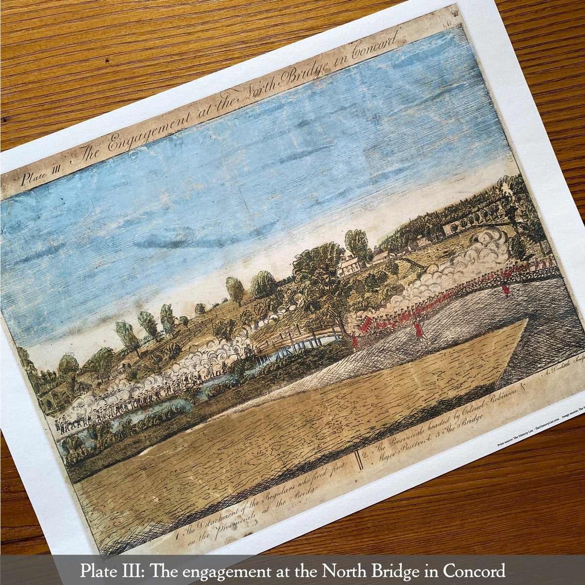
On April 19, 1775, 700 British Regulars marched from Boston with the intent of seizing and destroying canon and other military supplies reportedly stored in Concord. En route, they confronted about 80 Lexington militiamen who ranks on Lexington Common. They were out in the open and were not planning to confront the much larger British force. It’s never been determine who fired first, but after the brief skirmish, eight militiamen lay dead and ten wounded.One British soldier was wounded.
The Regulars proceeded to Concord where they split into companies to search for supplies. At the Old North Bridge in Concord, approximately 400 militiamen who had come from surrounding towns engaged 100 Regulars at about 11:00 am, resulting in casualties on both sides. The outnumbered Regulars fell back and rejoined the main body of British troops in Concord.
Ralph Waldo Emerson called it the “shot heard ’round the world” in his poem. Emerson lived for awhile in the Old Manse, a house owned by his father and that is located a stone’s throw from North Bridge. Both the Old Manse and North Bridge can be visited today.
The image is one of four from a set of engravings made shortly after the events of April 19 based on eyewitness interviews. The Museum of the American Revolution has this excerpt from the book, Eyewitness Images from the American Revolution, by Arthur Lefkowitz, on the creation of the four engravings by New Haven silversmith Amos Doolittle based on drawings done by his portrait-artist neighbor, Ralph Earl.
Learn more
In February 2025, in advance of the 250th anniversary of Lexington and Concord, we had a live History Camp Author Discussion about the events of that day. I was joined by John Bell, author of The Road to Concord: How Four Stolen Cannon Ignited the Revolutionary War, and Sam Forman, author of Dr. Joseph Warren: The Boston Tea Party, Bunker Hill, and the Birth of American Liberty. In addition, Sam is a reenactor who took part in the 250th reenactment on Lexington Green. You can watch the video of our discussion, which ran about an hour and a quarter.
You can also view more details about Amos Doolittle’s prints here.
Related products from The History List store

We have a set of four very high-quality archival reproductions of the engravings.
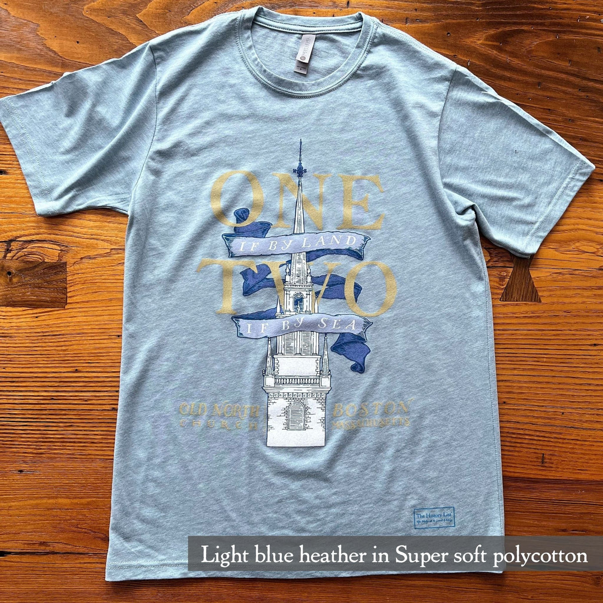
The evening of April 18 and into the early hours of April 19 is when Paul Revere took his famous ride. Our “One if by land” shirt and tea towel come from the Longfellow poem.
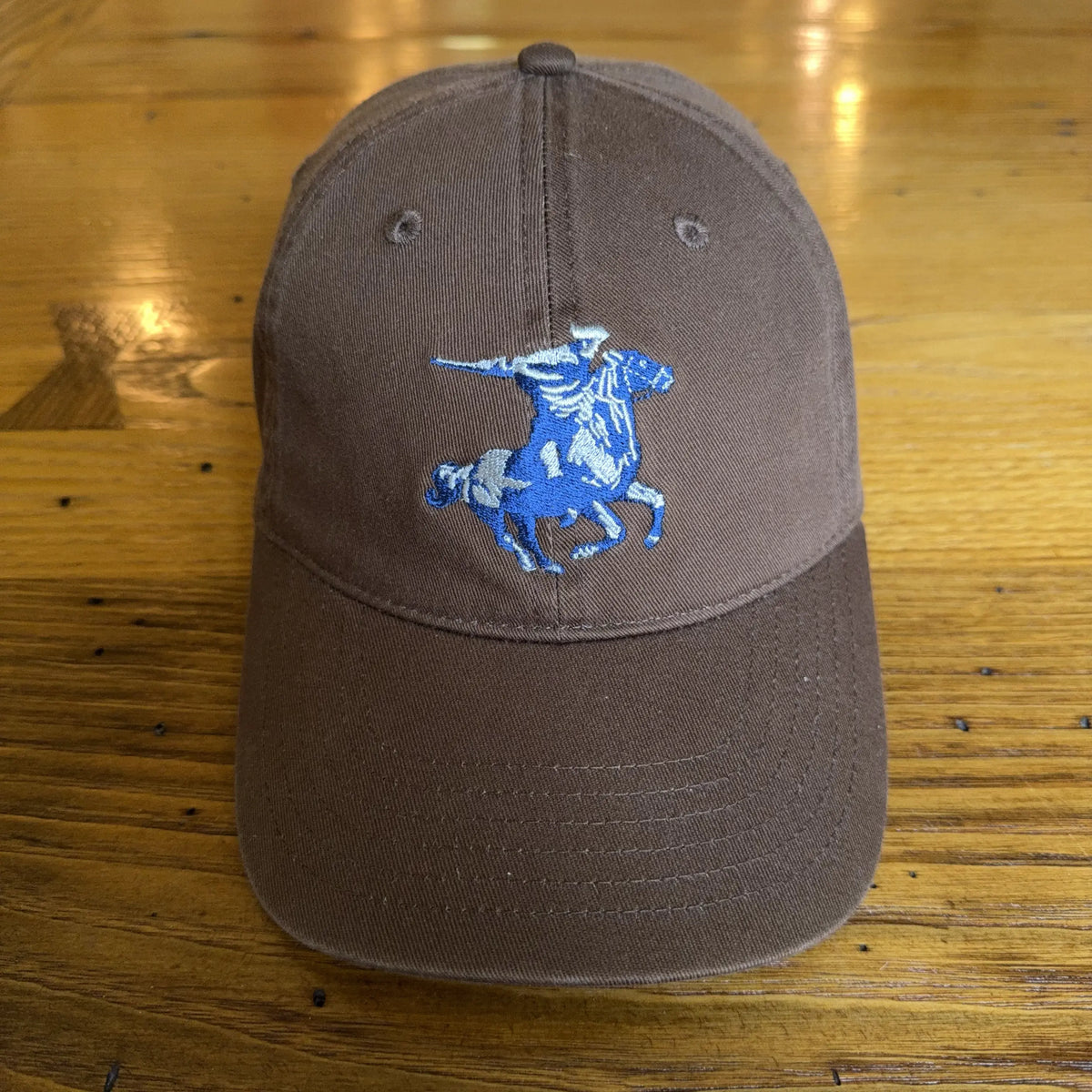
Revere was not the only rider, and our tongue-in-cheek “Prescott, Revere, and Dawes Express Delivery Service” t-shirt includes the two other riders that night who spread the word throughout the countryside en route to Lexington.

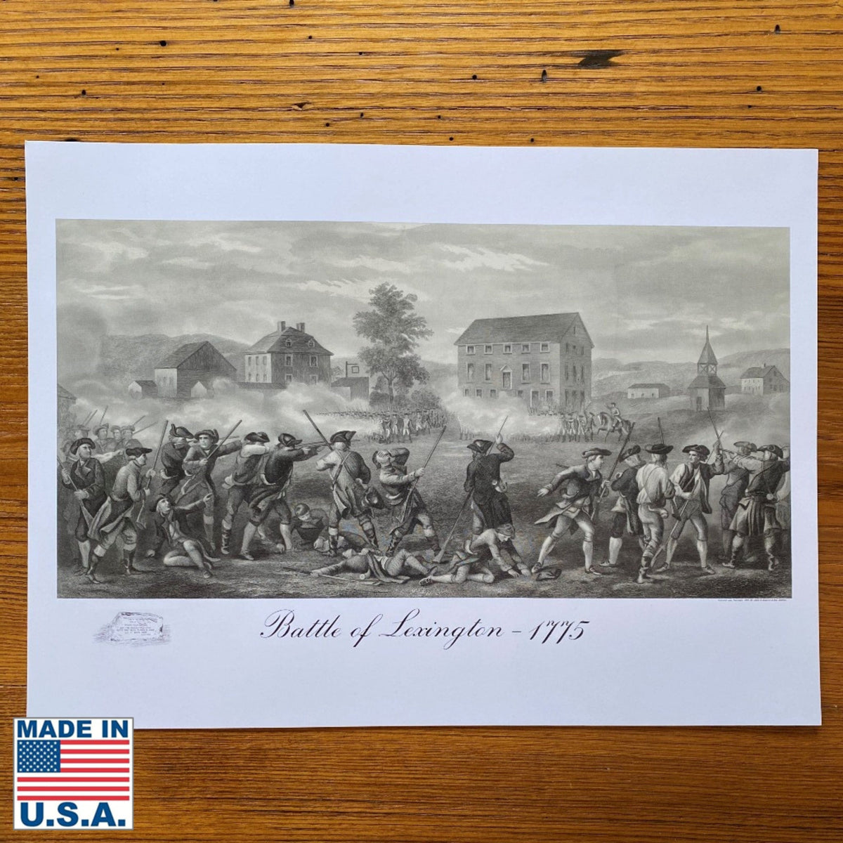
We also have an archival print of a1775 map with the Battle of Lexington and Concord and Billings’ depiction of the Battle of Lexington as an archival print.
Carpenters' Hall (Sept. 5 - Oct. 26, 1774)

The First Continental Congress met from September 5 to October 26, 1774 in Carpenters’ Hall in Philadelphia. Twelve of the thirteen colonies sent delegates. (Georgia did not send any delegates.)
The meeting was a response to the naval blockade of Boston Harbor and the passage of the Intolerable Acts in response to the Boston Tea Party.
The Congress’s first action was the adoption of the Suffolk Resolves, which had been drawn up by several counties in Massachusetts and included a declaration of grievances, a trade boycott of British goods, and an appeal to each colony to set up and train its own militia.
They also drew up a Petition to the King for redress of their grievances and repeal of the Intolerable Acts. That appeal was unsuccessful, and this led to the Second Continental Congress, also held in Philadelphia, the following May, shortly after the Battles of Lexington and Concord.
Carpenters’ Hall, built in 1771, is about two blocks from what was then the Pennsylvania State House and today we call Independence Hall. Carpenters’ Hall, which is privately owned, can be visited during much of the year. Learn more about Carpenters’ Hall on their website.
Why didn’t Georgia send any delegates?
It’s explained this way in the New Georgia Encyclopedia:
“Though Georgians opposed British trade regulations, many hesitated to join the revolutionary movement that emerged in the American colonies in the early 1770s and resulted in the Revolutionary War (1775-83). The colony had prospered under royal rule, and many Georgians thought that they needed the protection of British troops against a possible Indian attack.
“Georgia did not send representatives to the First Continental Congress that met in Philadelphia, Pennsylvania, in 1774. The Congress asked all colonies to form a group, called the Association, to ban trade with Britain. Georgia delegates gathered in a provincial congress in Savannah on January 18, 1775, to discuss whether to join the Association, and to elect representatives to the Second Continental Congress. Those who were elected declined to go to Philadelphia, however, because the delegates were divided on the action to be taken. St. John’s Parish, acting alone, sent Lyman Hall to the Second Continental Congress.”
Learn more
The Mount Vernon website has a good write up on the First Continental Congress.
Related products from The History List store
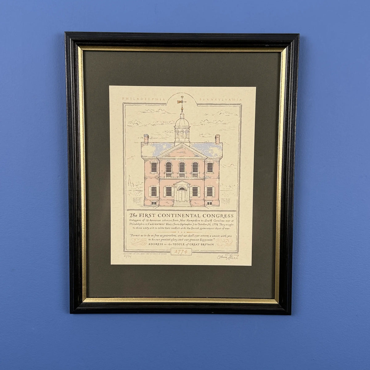
Limited edition print of Carpenters’ Hall issued for the 250th anniversary.
Boston Tea Party (December 16, 1773)

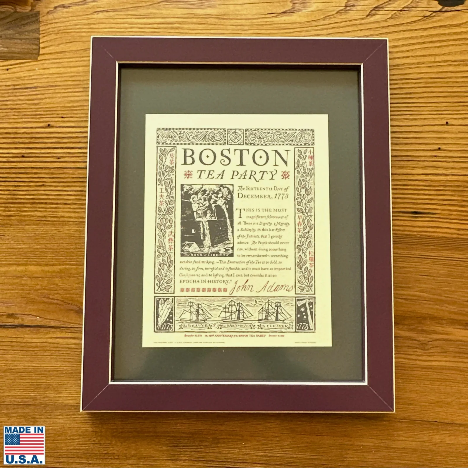
What we today call “The Boston Tea Party”—the first mention in print of it by that name was in 1825—took place the evening of December 16, 1773, after a town meeting at Old South Meeting House. Members of the Sons of Liberty, some dressed to resemble Native Americans, boarded the Dartmouth, the Eleanor, and the Beaver in Boston harbor, broke open 342 chests of tea, and dumped the contents, totaling 92,000 pounds, in Boston harbor. The value, in today’s dollars, was roughly $1.7 million.
This was an act of protest, not theft. A man who was seen to be putting some tea leaves in his pocket was treated roughly and his pockets emptied of the tea. The decks were swept and a padlock, which had been broken, was replaced the following day.
Other “tea parties” and tea protests took place up and down the East Coast.
The British government considered these an act of treason and responded in 1774 with what Patriots called the Intolerable Acts, which ended self-government in Massachusetts. One, the Boston Port Act passed on June 1, 1774, closed Boston’s port and halted all commercial activity until the destroyed tea was paid for.
The Boston Tea Party was one of the largest protests that led, ultimately, to the Declaration of Independence about two and half years later.
Image: 1846 print by Nathaniel Currier, entitled “Tea sabotage in Boston Port.”
Learn more
At History Camp Boston 2023, Christopher Sherwood Davis gave an excellent talk entitled, “The Boston Tea Party: Separating Myth from Reality after 250 Years.” You can watch the video here. The talk runs about 45 minutes. He is a former supervisor at the Boston Tea Party Ships & Museum.
Related products from The History List store
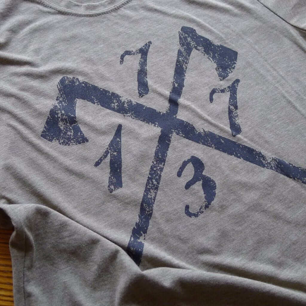
One of our earliest designs was this shirt, which doesn’t actually have the words “Boston Tea Party” on it, but anyone who sees it and who knows about the history of that period will know immediately what it refers to.
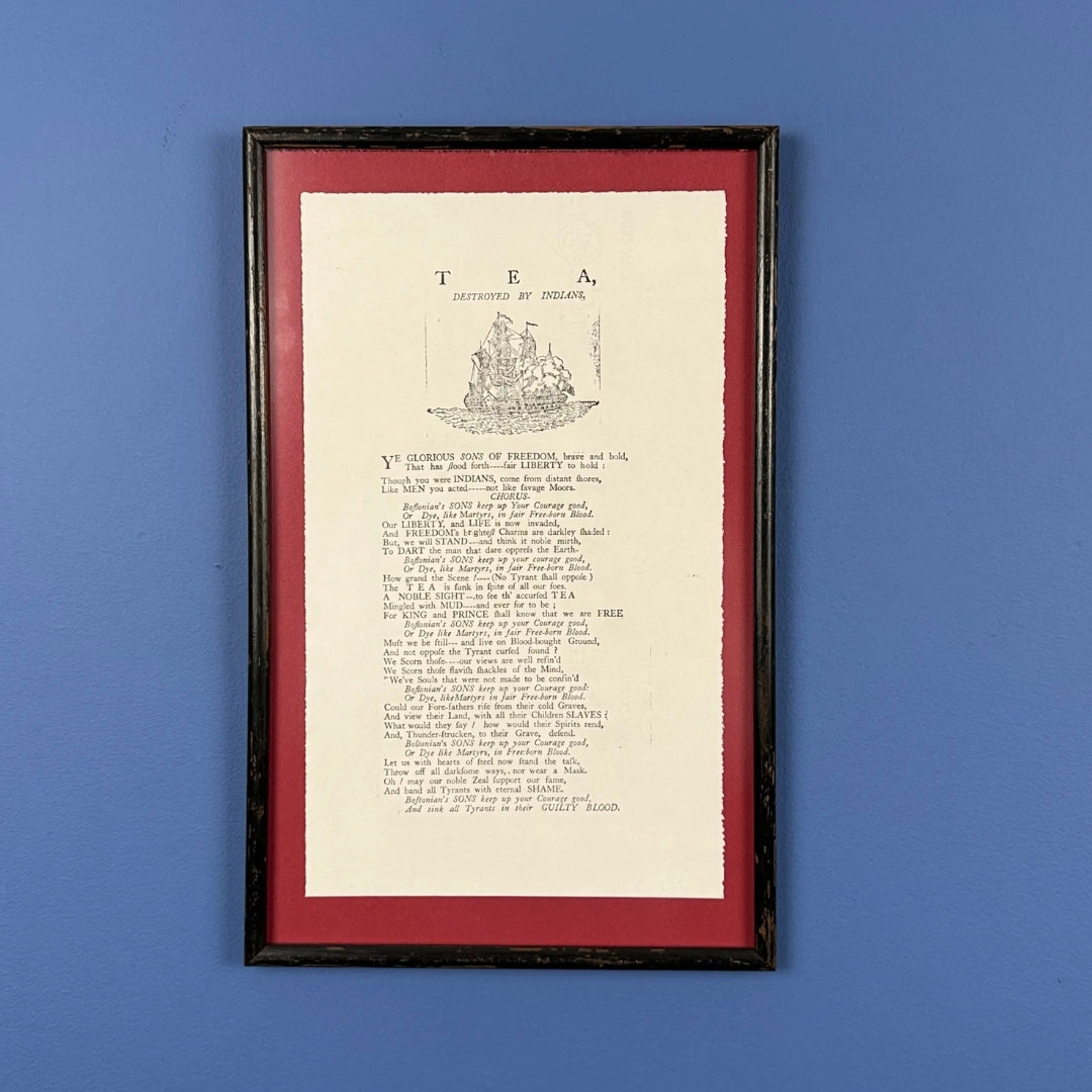
This broadside, with the text “Tea Destroyed by Indians” at the top, was distributed in Boston after the event. Our reproduction was printed by hand exactly as the original appeared.
You can still order our “1776 Declaration of Independence” advent calendar and our “Washington Crossing the Delaware” advent calendar.
The History
John Trumbull’s Declaration of Independence

John Trumbull‘s masterpiece, The Declaration of Independence of the United States of America, July 4th, 1776, was begun at Jefferson’s residence in Paris. It was the beginning of a very long process, ultimately taking him 33 years.
According to Trumbull:
“I began the composition of the Declaration of Independence, with the assistance of his [Jefferson’s] information and advice.”
Jefferson contributed a firsthand description of the Assembly Room and made a rough sketch of it. Later, Trumbull painted Jefferson from life for the Declaration and made three miniatures of the likeness. The committee responsible for the draft — John Adams, Roger Sherman, Robert R. Livingston, Jefferson, and Benjamin Franklin — was depicted to the right of center.
Trumbull dedicated himself to portraying from life as many of the forty-eight signers as he could. Consequently, the original painting, located in the Yale University Art Gallery, was not completed until 1820. The young artist Asher B. Durand was selected to make the engraving, which was published in 1823. The small number of subscribers greatly disappointed Trumbull.
Source: Monticello
Key to John Trumbull’s Declaration of Independence

Map of Philadelphia and the Independence Hall

Published by George Heap and created by Nicholas Scull in 1752
This map is considered one of the most important 18th-century maps of Philadelphia and its surrounding areas.
On the top, an early sketch of the majestic State House with two banners on each side.
On the left banner:
“This Building stands in a Square of 396 Feet by 255 Surrounded by a high Wall, the Ground is to be laid out in walks with Rows of Trees. In the Body of the House are two Rooms of 40 Feet Square & 20 Feet high, one for the Assembly, the other for the Supreme Court, between which is an Entry Hall of 40 Feet by 20. [O]n the Second Floor is the Council Chamber and Commette Room with a long Gallery 100 Feet by 20. The Publick Offices are kept in the Wings. It was founded Anno 1732.”
On the right banner:
“Anno 1749 the Dwelling Houses in Philadelphia were carefully numbered [counted], and found to be 2076. Other Publick Buildings are, The Court House, two Quaker Meeting Houses, two Presbyterean Meeting Houses, One Church of England, one Baptist meeting, one Dutch Lutheren Church, One Dutch Calvinist Church, one Moravian Church, one Mass House [Roman Catholic], the Academy, the Quakers School House, the City Alms House [for the poor] the Quakers Alms House the Hospital Prison and Work House.”
On the lower right hand:
“A table of Distances of Particular places within this map Begin at the Court House”
Nicholas Scull II (1687-1761) was the Surveyor General of Pennsylvania from 1748 to 1761. He came from a prominent family of surveyors and mapmakers in colonial Pennsylvania. His father, Nicholas Scull I, was also a surveyor who worked with William Penn.
According to John Brown Carter Library:
“The majestic state house occupies the top third of this first engraved map of the city of Philadelphia.
“While the map was based on the surveys of the city completed by the official city surveyor, George Heap, the rendering of the façade of the state house was drawn by Nicolas Scull. At the time of its drawing, the building was not, in fact, complete, and Heap’s depiction was based on city plans, thus showing it as it would appear in the future. Republished more than any other map of Philadelphia, the map shows the city embedded within a vibrant and dense network of roadways, farms and villages (its ‘Parts Adjacent’) alongside the Delaware River.”